Atoyac geodata
Atoyac (Veracruz) is a populated place; located in Mexico in America/Mexico_City (GMT-6) time zone. With population of 2,755 people, there are 3211 cities with bigger population in this country. Compared to other cities in Mexico, 66.7% of cities are located further ↑North; 77.5% of cities are located further ←West and 68.6% of cities have higher elevation than Atoyac. Note1


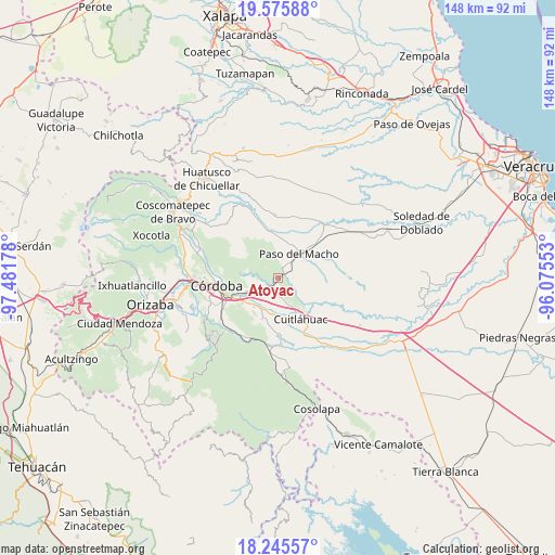
Atoyac GPS coordinates[2]
18° 54' 43.38" North, 96° 46' 43.14" West
| Map corner | latitude | longitude |
|---|---|---|
| Upper-left | 19.57588°, | -97.48178° |
| Center: | 18.91205°, | -96.77865° |
| Lower-right: | 18.24557°, | -96.07553° |
| Map W x H: | 147.9×147.9 km | = 91.9×91.9mi |
| max Lat: | 32.7° ⇑66.7% North |
| Atoyac: | 18.91205° |
| min Lat: | ⇓33.3% South 14.53588° |
| min Long | Atoyac | max Long |
| -117.105° | -96.77865° | -86.73105° |
| W 77.5%⇐ | ⇒22.5% E |
Elevation
Elevation of Atoyac is 491 m = 1611 ft, and this is 762.7 m = 2502 ft below average elevation for this country.
| Max E: |
3497 m = 11473 ft | 68.6% |
| Avg. | 1253.7 m = 4113 ft | |
| Atoyac | 491 m = 1611 ft | |
Min E: |
-1 m = -3 ft | 31.4% |
See also: Mexico elevation on elevation.city.
Geographical zone
Atoyac is located in North Torrid zone (between Equator and Tropic of Cancer). Distance of this Northern Tropic circle is 503.1 km =312.6 mi to North.| Distance of | km | miles | from Atoyac |
|---|---|---|---|
| North Pole | 7904.2 | 4911.4 | to North |
| Arctic Circle | 5298.4 | 3292.3 | to North |
| Tropic Cancer | 503.1 | 312.6 | to North |
| Equator | 2102.8 | 1306.6 | to South |


Nearby cities:
15 places around Atoyac: (largest is in red/bold)
• Buenos Aires
3.5 km =2.2 mi,  20°
20°
• Cañada Blanca
9.2 km =5.7 mi,  298°
298°
• Corral de Piedra
6.5 km =4 mi,  164°
164°
• Ex-hacienda la Concepción
8.5 km =5.3 mi,  214°
214°
• General Alatriste (San Joaquín)
8.1 km =5 mi,  191°
191°
• General Francisco Paz (El Poblado)
8.2 km =5.1 mi,  200°
200°
• General Miguel Alemán
2.5 km =1.6 mi, 214°
• Ignacio Zaragoza
5.9 km =3.7 mi,  276°
276°
• La Charca
7 km =4.3 mi,  331°
331°
• Paso del Macho
8.7 km =5.4 mi,  41°
41°
• Potrero Viejo
7.8 km =4.8 mi,  240°
240°
• Salvador Esquer Apodaca [Unidad Habitacional]
7.9 km =4.9 mi,  50°
50°
• San Francisco de las Mesillas
9.1 km =5.7 mi,  178°
178°
• San José Balsa Camarón
8.2 km =5.1 mi,  71°
71°
• Yanga
9 km =5.6 mi, 193°
Sources, notices
• [Note1] Compared only with cities in Mexico existing in our database
• [Src1] Map data: © OpenStreetMap contributors (CC-BY-SA)
• [Src2] Other city data from geonames.org with taken over terms of usage.
• [Src3] Geographical zone / Annual Mean Temperature by Robert A. Rohde @ Wikipedia
