General Miguel Alemán geodata
General Miguel Alemán (Veracruz) is a populated place; located in Mexico in America/Mexico_City (GMT-6) time zone. With population of 14,287 people, there are 675 cities with bigger population in this country. Compared to other cities in Mexico, 67.2% of cities are located further ↑North; 77.3% of cities are located further ←West and 68.2% of cities have higher elevation than General Miguel Alemán. Note1
Current local time in General Miguel Alemán:
02:06 AM, ThursdayDifference from your time zone: hours


General Miguel Alemán GPS coordinates[2]
18° 53' 36.456" North, 96° 47' 32.604" West
| Map corner | latitude | longitude |
|---|---|---|
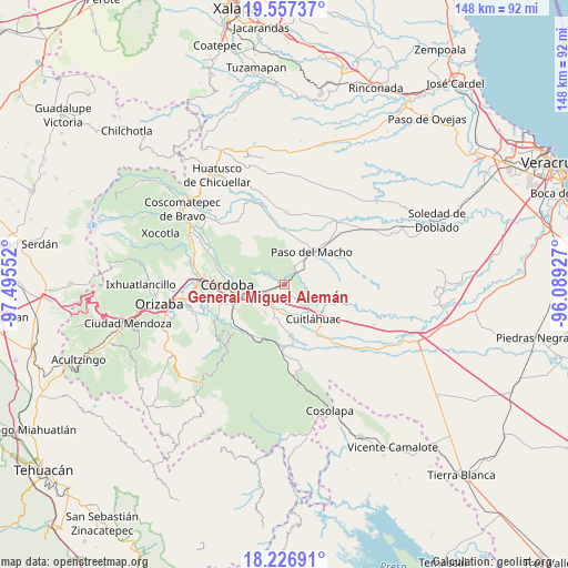
| Upper-left | 19.55737°, | -97.49552° |
| Center: | 18.89346°, | -96.79239° |
| Lower-right: | 18.22691°, | -96.08927° |
| Map W x H: | 147.9×147.9 km | = 91.9×91.9mi |
| max Lat: | 32.7° ⇑67.2% North |
| General Miguel Alemán: | 18.89346° |
| min Lat: | ⇓32.8% South 14.53588° |
| min Long | General Miguel | max Long |
| -117.105° | -96.79239° | -86.73105° |
| W 77.3%⇐ | ⇒22.7% E |
Elevation
Elevation of General Miguel Alemán is 521 m = 1709 ft, and this is 732.7 m = 2404 ft below average elevation for this country.
| Max E: |
3497 m = 11473 ft | 68.2% |
| Avg. | 1253.7 m = 4113 ft | |
| General Miguel Alemán | 521 m = 1709 ft | |
Min E: |
-1 m = -3 ft | 31.8% |
See also: Mexico elevation on elevation.city.
Geographical zone
General Miguel Alemán is located in North Torrid zone (between Equator and Tropic of Cancer). Distance of this Northern Tropic circle is 505.2 km =313.9 mi to North.| Distance of | km | miles | from General Miguel Alemán |
|---|---|---|---|
| North Pole | 7906.3 | 4912.7 | to North |
| Arctic Circle | 5300.4 | 3293.5 | to North |
| Tropic Cancer | 505.2 | 313.9 | to North |
| Equator | 2100.8 | 1305.4 | to South |


Nearby cities:
15 places around General Miguel Alemán: (largest is in red/bold)
• Atoyac
2.5 km =1.6 mi,  34°
34°
• Buenos Aires
6 km =3.7 mi, 26°
• Corral de Piedra
5.3 km =3.3 mi,  142°
142°
• Ex-hacienda la Concepción
6 km =3.7 mi,  213°
213°
• General Alatriste (San Joaquín)
5.9 km =3.7 mi,  181°
181°
• General Francisco Paz (El Poblado)
5.8 km =3.6 mi,  193°
193°
• General Juan José Baz (San José del Corral)
8.4 km =5.2 mi,  198°
198°
• Ignacio Zaragoza
5.2 km =3.2 mi,  301°
301°
• La Charca
8.4 km =5.2 mi,  347°
347°
• Paraje Nuevo
7.4 km =4.6 mi,  257°
257°
• Potrero Viejo
5.7 km =3.5 mi,  251°
251°
• San Antonio Fraternidad
7.4 km =4.6 mi,  223°
223°
• San Francisco de las Mesillas
7.3 km =4.5 mi,  166°
166°
• Venta Parada
7.6 km =4.7 mi,  232°
232°
• Yanga
6.8 km =4.2 mi, 185°
Sources, notices
• [Note1] Compared only with cities in Mexico existing in our database
• [Src1] Map data: © OpenStreetMap contributors (CC-BY-SA)
• [Src2] Other city data from geonames.org with taken over terms of usage.
• [Src3] Geographical zone / Annual Mean Temperature by Robert A. Rohde @ Wikipedia
