Paso del Macho geodata
Paso del Macho (Veracruz) is a seat of a second-order administrative division; located in Mexico in America/Mexico_City (GMT-6) time zone. With population of 13,413 people, there are 726 cities with bigger population in this country. Compared to other cities in Mexico, 65.3% of cities are located further ↑North; 78.1% of cities are located further ←West and 68.7% of cities have higher elevation than Paso del Macho. Note1


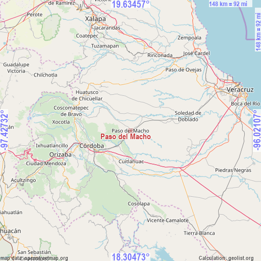
Paso del Macho GPS coordinates[2]
18° 58' 15.528" North, 96° 43' 27.084" West
| Map corner | latitude | longitude |
|---|---|---|
| Upper-left | 19.63457°, | -97.42732° |
| Center: | 18.97098°, | -96.72419° |
| Lower-right: | 18.30473°, | -96.02107° |
| Map W x H: | 147.9×147.9 km | = 91.9×91.9mi |
| max Lat: | 32.7° ⇑65.3% North |
| Paso del Macho: | 18.97098° |
| min Lat: | ⇓34.7% South 14.53588° |
| min Long | Paso del Macho | max Long |
| -117.105° | -96.72419° | -86.73105° |
| W 78.1%⇐ | ⇒21.9% E |
Elevation
Elevation of Paso del Macho is 489 m = 1604 ft, and this is 764.7 m = 2509 ft below average elevation for this country.
| Max E: |
3497 m = 11473 ft | 68.7% |
| Avg. | 1253.7 m = 4113 ft | |
| Paso del Macho | 489 m = 1604 ft | |
Min E: |
-1 m = -3 ft | 31.3% |
See also: Mexico elevation on elevation.city.
Geographical zone
Paso del Macho is located in North Torrid zone (between Equator and Tropic of Cancer). Distance of this Northern Tropic circle is 496.5 km =308.5 mi to North.| Distance of | km | miles | from Paso del Macho |
|---|---|---|---|
| North Pole | 7897.7 | 4907.4 | to North |
| Arctic Circle | 5291.8 | 3288.2 | to North |
| Tropic Cancer | 496.5 | 308.5 | to North |
| Equator | 2109.4 | 1310.7 | to South |


Nearby cities:
15 places around Paso del Macho: (largest is in red/bold)
• Atoyac
8.7 km =5.4 mi,  221°
221°
• Buenos Aires
5.6 km =3.5 mi,  233°
233°
• Camarón de Tejeda
12.8 km =8 mi,  63°
63°
• Cerro Azul
8.6 km =5.3 mi,  294°
294°
• Ejido la Piña (Maromilla)
8.9 km =5.5 mi,  315°
315°
• General Miguel Alemán
11.2 km =7 mi, 219°
• La Charca
9.1 km =5.7 mi,  267°
267°
• Mata Naranjo
5.7 km =3.5 mi,  311°
311°
• Mata de Varas
7.8 km =4.8 mi,  46°
46°
• Palo Gacho
10.8 km =6.7 mi, 305°
• Paso Mulato
11.2 km =7 mi,  163°
163°
• Progreso
11.5 km =7.1 mi, 285°
• Pueblito de Matlaluca
12.4 km =7.7 mi,  327°
327°
• Salvador Esquer Apodaca [Unidad Habitacional]
1.6 km =1 mi, 164°
• San José Balsa Camarón
4.4 km =2.7 mi,  152°
152°
Sources, notices
• [Note1] Compared only with cities in Mexico existing in our database
• [Src1] Map data: © OpenStreetMap contributors (CC-BY-SA)
• [Src2] Other city data from geonames.org with taken over terms of usage.
• [Src3] Geographical zone / Annual Mean Temperature by Robert A. Rohde @ Wikipedia
