La Charca geodata
La Charca (Veracruz) is a populated place; located in Mexico in America/Mexico_City (GMT-6) time zone. With population of 612 people, there are 14088 cities with bigger population in this country. Compared to other cities in Mexico, 65.4% of cities are located further ↑North; 77.1% of cities are located further ←West and 62.7% of cities have higher elevation than La Charca. Note1


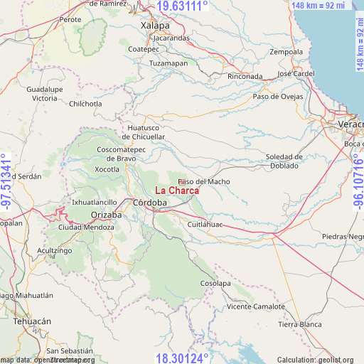
La Charca GPS coordinates[2]
18° 58' 3" North, 96° 48' 37.008" West
| Map corner | latitude | longitude |
|---|---|---|
| Upper-left | 19.63111°, | -97.51341° |
| Center: | 18.9675°, | -96.81028° |
| Lower-right: | 18.30124°, | -96.10716° |
| Map W x H: | 147.9×147.9 km | = 91.9×91.9mi |
| max Lat: | 32.7° ⇑65.4% North |
| La Charca: | 18.9675° |
| min Lat: | ⇓34.6% South 14.53588° |
| min Long | La Charca | max Long |
| -117.105° | -96.81028° | -86.73105° |
| W 77.1%⇐ | ⇒22.9% E |
Elevation
Elevation of La Charca is 841 m = 2759 ft, and this is 412.7 m = 1354 ft below average elevation for this country.
| Max E: |
3497 m = 11473 ft | 62.7% |
| Avg. | 1253.7 m = 4113 ft | |
| La Charca | 841 m = 2759 ft | |
Min E: |
-1 m = -3 ft | 37.3% |
See also: Mexico elevation on elevation.city.
Geographical zone
La Charca is located in North Torrid zone (between Equator and Tropic of Cancer). Distance of this Northern Tropic circle is 496.9 km =308.8 mi to North.| Distance of | km | miles | from La Charca |
|---|---|---|---|
| North Pole | 7898.1 | 4907.7 | to North |
| Arctic Circle | 5292.2 | 3288.4 | to North |
| Tropic Cancer | 496.9 | 308.8 | to North |
| Equator | 2109 | 1310.5 | to South |


Nearby cities:
15 places around La Charca: (largest is in red/bold)
• Atoyac
7 km =4.3 mi,  151°
151°
• Buenos Aires
5.4 km =3.4 mi,  122°
122°
• Cañada Blanca
5 km =3.1 mi,  249°
249°
• Cerro Azul
4.2 km =2.6 mi,  16°
16°
• Ejido la Piña (Maromilla)
7.4 km =4.6 mi, 22°
• Ejido los Naranjos
5 km =3.1 mi,  269°
269°
• General Miguel Alemán
8.4 km =5.2 mi,  167°
167°
• Ignacio Zaragoza
6.1 km =3.8 mi,  205°
205°
• La Palma
8.9 km =5.5 mi,  348°
348°
• Mata Naranjo
6.4 km =4 mi,  49°
49°
• Palo Gacho
6.6 km =4.1 mi,  2°
2°
• Plan de Ayala
7.3 km =4.5 mi, 266°
• Progreso
4.1 km =2.5 mi,  330°
330°
• San José Tenejapa
6.4 km =4 mi, 327°
• Álvaro Obregón
7.6 km =4.7 mi,  305°
305°
Sources, notices
• [Note1] Compared only with cities in Mexico existing in our database
• [Src1] Map data: © OpenStreetMap contributors (CC-BY-SA)
• [Src2] Other city data from geonames.org with taken over terms of usage.
• [Src3] Geographical zone / Annual Mean Temperature by Robert A. Rohde @ Wikipedia
