Angel Díaz geodata
Angel Díaz (Chiapas) is a populated place; located in Mexico in America/Mexico_City (GMT-6) time zone. With population of 587 people, there are 14622 cities with bigger population in this country. Compared to other cities in Mexico, 98.5% of cities are located further ↑North; 92.7% of cities are located further ←West and 58.2% of cities have lower elevation than Angel Díaz. Note1


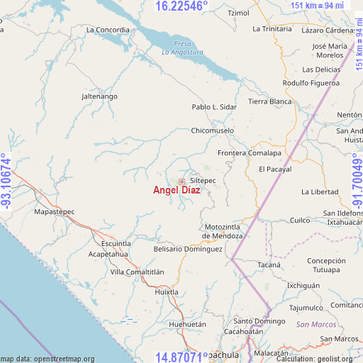
Angel Díaz GPS coordinates[2]
15° 32' 57.12" North, 92° 24' 12.996" West
| Map corner | latitude | longitude |
|---|---|---|
| Upper-left | 16.22546°, | -93.10674° |
| Center: | 15.5492°, | -92.40361° |
| Lower-right: | 14.87071°, | -91.70049° |
| Map W x H: | 150.6×150.6 km | = 93.6×93.6mi |
| max Lat: | 32.7° ⇑98.5% North |
| Angel Díaz: | 15.5492° |
| min Lat: | ⇓1.5% South 14.53588° |
| min Long | Angel Díaz | max Long |
| -117.105° | -92.40361° | -86.73105° |
| W 92.7%⇐ | ⇒7.3% E |
Elevation
Elevation of Angel Díaz is 1694 m = 5558 ft, and this is 440.3 m = 1445 ft above average elevation for this country.
| Max E: |
3497 m = 11473 ft | 41.8% |
| Angel Díaz | 1694 m 5558 ft | |
| Avg. | 1253.7 m = 4113 ft | |
Min E: |
-1 m = -3 ft | 58.2% |
See also: Mexico elevation on elevation.city.
Geographical zone
Angel Díaz is located in North Torrid zone (between Equator and Tropic of Cancer). Distance of this Northern Tropic circle is 877 km =544.9 mi to North.| Distance of | km | miles | from Angel Díaz |
|---|---|---|---|
| North Pole | 8278.2 | 5143.8 | to North |
| Arctic Circle | 5672.3 | 3524.6 | to North |
| Tropic Cancer | 877 | 544.9 | to North |
| Equator | 1728.9 | 1074.3 | to South |


Nearby cities:
15 places around Angel Díaz: (largest is in red/bold)
• Buenos Aires
11 km =6.8 mi,  291°
291°
• Cumbre Ventanas
11.1 km =6.9 mi,  89°
89°
• Honduras
9 km =5.6 mi,  299°
299°
• La Soledad
9.4 km =5.8 mi, 287°
• Las Cruces
7.9 km =4.9 mi, 94°
• Las Delicias
14.2 km =8.8 mi,  311°
311°
• Las Moras
2.9 km =1.8 mi, 292°
• Las Salvias
15.1 km =9.4 mi,  135°
135°
• Libertad Ventanas
13.7 km =8.5 mi, 94°
• Pablo Galeana
14.9 km =9.3 mi,  279°
279°
• Pinada de Arriba
11.5 km =7.1 mi,  48°
48°
• Santo Domingo (La Cascada)
7 km =4.3 mi,  180°
180°
• Siltepec
8.7 km =5.4 mi,  84°
84°
• Toquián Grande
5.7 km =3.5 mi,  112°
112°
• Vega del Rosario
10.8 km =6.7 mi, 106°
Sources, notices
• [Note1] Compared only with cities in Mexico existing in our database
• [Src1] Map data: © OpenStreetMap contributors (CC-BY-SA)
• [Src2] Other city data from geonames.org with taken over terms of usage.
• [Src3] Geographical zone / Annual Mean Temperature by Robert A. Rohde @ Wikipedia
