Aldama geodata
Aldama (Tamaulipas) is a seat of a second-order administrative division; located in Mexico in America/Monterrey (GMT-6) time zone. With population of 13,661 people, there are 713 cities with bigger population in this country. Compared to other cities in Mexico, 87.8% of cities are located further ↓South; 62.7% of cities are located further ←West and 77.9% of cities have higher elevation than Aldama. Note1


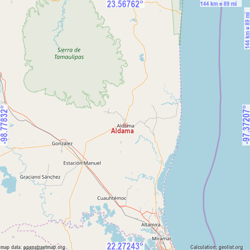
Aldama GPS coordinates[2]
22° 55' 17.652" North, 98° 4' 30.684" West
| Map corner | latitude | longitude |
|---|---|---|
| Upper-left | 23.56762°, | -98.77832° |
| Center: | 22.92157°, | -98.07519° |
| Lower-right: | 22.27243°, | -97.37207° |
| Map W x H: | 144×144 km | = 89.5×89.5mi |
| max Lat: | 32.7° ⇑12.2% North |
| Aldama: | 22.92157° |
| min Lat: | ⇓87.8% South 14.53588° |
| min Long | Aldama | max Long |
| -117.105° | -98.07519° | -86.73105° |
| W 62.7%⇐ | ⇒37.3% E |
Elevation
Elevation of Aldama is 133 m = 436 ft, and this is 1120.7 m = 3677 ft below average elevation for this country.
| Max E: |
3497 m = 11473 ft | 77.9% |
| Avg. | 1253.7 m = 4113 ft | |
| Aldama | 133 m = 436 ft | |
Min E: |
-1 m = -3 ft | 22.1% |
See also: Mexico elevation on elevation.city.
Geographical zone
Aldama is located in North Torrid zone (between Equator and Tropic of Cancer). Distance of this Northern Tropic circle is 57.3 km =35.6 mi to North.| Distance of | km | miles | from Aldama |
|---|---|---|---|
| North Pole | 7458.4 | 4634.4 | to North |
| Arctic Circle | 4852.5 | 3015.2 | to North |
| Tropic Cancer | 57.3 | 35.6 | to North |
| Equator | 2548.6 | 1583.6 | to South |


Nearby cities:
15 places around Aldama: (largest is in red/bold)
• Aquiles Serdán
43.3 km =26.9 mi,  156°
156°
• Barra el Tordo
34.1 km =21.2 mi,  65°
65°
• Benito Juárez
48.2 km =30 mi,  174°
174°
• Cuauhtémoc
42.7 km =26.5 mi,  190°
190°
• Esteros
44.9 km =27.9 mi, 186°
• Francisco I. Madero
10.5 km =6.5 mi,  195°
195°
• González
37.5 km =23.3 mi,  253°
253°
• Higinio Tanguma
19.8 km =12.3 mi, 247°
• José María Luis Mora
35.3 km =21.9 mi, 174°
• Lomas del Real
48.1 km =29.9 mi, 157°
• Maclovio Herrera
46.8 km =29.1 mi,  181°
181°
• Nuevo Cereso Regional de Altamira
51.7 km =32.1 mi, 172°
• Nuevo Progreso
31.1 km =19.3 mi,  24°
24°
• Santa Fe
39.6 km =24.6 mi, 247°
• Ursulo Galván
33.2 km =20.6 mi,  229°
229°
Sources, notices
• [Note1] Compared only with cities in Mexico existing in our database
• [Src1] Map data: © OpenStreetMap contributors (CC-BY-SA)
• [Src2] Other city data from geonames.org with taken over terms of usage.
• [Src3] Geographical zone / Annual Mean Temperature by Robert A. Rohde @ Wikipedia
