Santa Fe geodata
Santa Fe (Tamaulipas) is a populated place; located in Mexico in America/Monterrey (GMT-6) time zone. With population of 945 people, there are 9215 cities with bigger population in this country. Compared to other cities in Mexico, 87.5% of cities are located further ↓South; 58.2% of cities are located further ←West and 81.3% of cities have higher elevation than Santa Fe. Note1


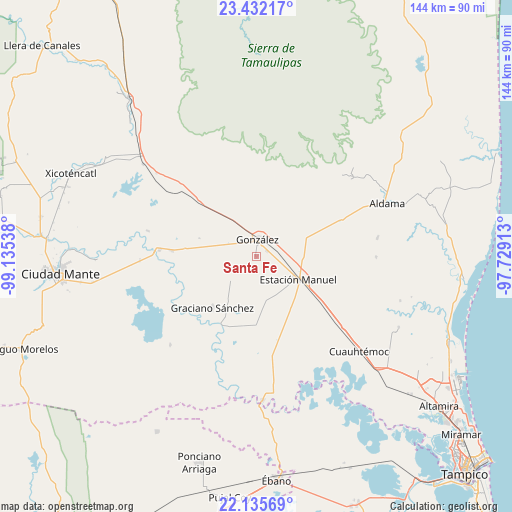
Santa Fe GPS coordinates[2]
22° 47' 7.692" North, 98° 25' 56.1" West
| Map corner | latitude | longitude |
|---|---|---|
| Upper-left | 23.43217°, | -99.13538° |
| Center: | 22.78547°, | -98.43225° |
| Lower-right: | 22.13569°, | -97.72913° |
| Map W x H: | 144.2×144.2 km | = 89.6×89.6mi |
| max Lat: | 32.7° ⇑12.5% North |
| Santa Fe: | 22.78547° |
| min Lat: | ⇓87.5% South 14.53588° |
| min Long | Santa Fe | max Long |
| -117.105° | -98.43225° | -86.73105° |
| W 58.2%⇐ | ⇒41.8% E |
Elevation
Elevation of Santa Fe is 78 m = 256 ft, and this is 1175.7 m = 3857 ft below average elevation for this country.
| Max E: |
3497 m = 11473 ft | 81.3% |
| Avg. | 1253.7 m = 4113 ft | |
| Santa Fe | 78 m = 256 ft | |
Min E: |
-1 m = -3 ft | 18.7% |
See also: Mexico elevation on elevation.city.
Geographical zone
Santa Fe is located in North Torrid zone (between Equator and Tropic of Cancer). Distance of this Northern Tropic circle is 72.4 km =45 mi to North.| Distance of | km | miles | from Santa Fe |
|---|---|---|---|
| North Pole | 7473.6 | 4643.9 | to North |
| Arctic Circle | 4867.7 | 3024.6 | to North |
| Tropic Cancer | 72.4 | 45 | to North |
| Equator | 2533.5 | 1574.2 | to South |


Nearby cities:
15 places around Santa Fe: (largest is in red/bold)
• Adolfo Ruiz Cortines
19.2 km =11.9 mi,  188°
188°
• Aldama
39.6 km =24.6 mi,  67°
67°
• Cuauhtémoc
39.4 km =24.5 mi,  132°
132°
• El Camotero Dos
34.9 km =21.7 mi,  224°
224°
• Francisco I. Madero
34.2 km =21.3 mi,  81°
81°
• González
4.7 km =2.9 mi,  6°
6°
• Graciano Sánchez
19.2 km =11.9 mi, 220°
• Higinio Tanguma
19.8 km =12.3 mi, 67°
• Los Aztecas
36.7 km =22.8 mi,  210°
210°
• López Rayón
32.1 km =19.9 mi, 185°
• Magiscatzin
27.4 km =17 mi,  274°
274°
• Nueva Apolonia
38 km =23.6 mi, 212°
• Tantoyuquita
29.8 km =18.5 mi,  204°
204°
• Ursulo Galván
13 km =8.1 mi,  119°
119°
• Venustiano Carranza Dos
31.5 km =19.6 mi,  283°
283°
Sources, notices
• [Note1] Compared only with cities in Mexico existing in our database
• [Src1] Map data: © OpenStreetMap contributors (CC-BY-SA)
• [Src2] Other city data from geonames.org with taken over terms of usage.
• [Src3] Geographical zone / Annual Mean Temperature by Robert A. Rohde @ Wikipedia
