Zacualpan geodata
Zacualpan (Guerrero) is a populated place; located in Mexico in America/Mexico_City (GMT-6) time zone. With population of 579 people, there are 14804 cities with bigger population in this country. Compared to other cities in Mexico, 81.5% of cities are located further ↑North; 56.1% of cities are located further ←West and 54.5% of cities have lower elevation than Zacualpan. Note1


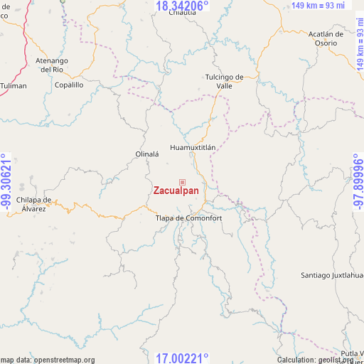
Zacualpan GPS coordinates[2]
17° 40' 24.168" North, 98° 36' 11.088" West
| Map corner | latitude | longitude |
|---|---|---|
| Upper-left | 18.34206°, | -99.30621° |
| Center: | 17.67338°, | -98.60308° |
| Lower-right: | 17.00221°, | -97.89996° |
| Map W x H: | 149×149 km | = 92.6×92.6mi |
| max Lat: | 32.7° ⇑81.5% North |
| Zacualpan: | 17.67338° |
| min Lat: | ⇓18.5% South 14.53588° |
| min Long | Zacualpan | max Long |
| -117.105° | -98.60308° | -86.73105° |
| W 56.1%⇐ | ⇒43.9% E |
Elevation
Elevation of Zacualpan is 1574 m = 5164 ft, and this is 320.3 m = 1051 ft above average elevation for this country.
| Max E: |
3497 m = 11473 ft | 45.5% |
| Zacualpan | 1574 m 5164 ft | |
| Avg. | 1253.7 m = 4113 ft | |
Min E: |
-1 m = -3 ft | 54.5% |
See also: Mexico elevation on elevation.city.
Geographical zone
Zacualpan is located in North Torrid zone (between Equator and Tropic of Cancer). Distance of this Northern Tropic circle is 640.8 km =398.2 mi to North.| Distance of | km | miles | from Zacualpan |
|---|---|---|---|
| North Pole | 8042 | 4997.1 | to North |
| Arctic Circle | 5436.1 | 3377.8 | to North |
| Tropic Cancer | 640.8 | 398.2 | to North |
| Equator | 1965.1 | 1221.1 | to South |


Nearby cities:
15 places around Zacualpan: (largest is in red/bold)
• Ahuatepec Pueblo
7.7 km =4.8 mi,  169°
169°
• Alpoyeca
9.9 km =6.2 mi,  91°
91°
• Chiepetlán (San Miguel Chiepetlán)
4.8 km =3 mi,  245°
245°
• Coachimalco
9.9 km =6.2 mi,  237°
237°
• Coatlaco
4.8 km =3 mi,  307°
307°
• Coyahualco
8.5 km =5.3 mi,  27°
27°
• Cualác
9.9 km =6.2 mi,  322°
322°
• San José Buenavista
8.2 km =5.1 mi, 90°
• San Martín Jolalpan
8.8 km =5.5 mi, 308°
• San Pedro Aytec
8.6 km =5.3 mi,  71°
71°
• Santa Cruz
11 km =6.8 mi,  18°
18°
• Tenango Tepexi
8.1 km =5 mi,  206°
206°
• Tlalquetzala
7.7 km =4.8 mi,  62°
62°
• Tlaquiltepec
8.7 km =5.4 mi,  42°
42°
• Tlatzala
8.6 km =5.3 mi,  138°
138°
Sources, notices
• [Note1] Compared only with cities in Mexico existing in our database
• [Src1] Map data: © OpenStreetMap contributors (CC-BY-SA)
• [Src2] Other city data from geonames.org with taken over terms of usage.
• [Src3] Geographical zone / Annual Mean Temperature by Robert A. Rohde @ Wikipedia
