Hermenegildo Galeana geodata
Hermenegildo Galeana (Puebla) is a populated place; located in Mexico in America/Mexico_City (GMT-6) time zone. With population of 1,047 people, there are 8321 cities with bigger population in this country. Compared to other cities in Mexico, 75.5% of cities are located further ↑North; 62.5% of cities are located further ←West and 51% of cities have higher elevation than Hermenegildo Galeana. Note1


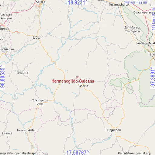
Hermenegildo Galeana GPS coordinates[2]
18° 15' 24.012" North, 98° 6' 7.992" West
| Map corner | latitude | longitude |
|---|---|---|
| Upper-left | 18.9231°, | -98.80535° |
| Center: | 18.25667°, | -98.10222° |
| Lower-right: | 17.58767°, | -97.3991° |
| Map W x H: | 148.5×148.5 km | = 92.3×92.3mi |
| max Lat: | 32.7° ⇑75.5% North |
| Hermenegildo Galeana: | 18.25667° |
| min Lat: | ⇓24.5% South 14.53588° |
| min Long | Hermenegildo Ga | max Long |
| -117.105° | -98.10222° | -86.73105° |
| W 62.5%⇐ | ⇒37.5% E |
Elevation
Elevation of Hermenegildo Galeana is 1382 m = 4534 ft, and this is 128.3 m = 421 ft above average elevation for this country.
| Max E: |
3497 m = 11473 ft | 51% |
| Hermenegildo Galeana | 1382 m 4534 ft | |
| Avg. | 1253.7 m = 4113 ft | |
Min E: |
-1 m = -3 ft | 49% |
See also: Mexico elevation on elevation.city.
Geographical zone
Hermenegildo Galeana is located in North Torrid zone (between Equator and Tropic of Cancer). Distance of this Northern Tropic circle is 576 km =357.9 mi to North.| Distance of | km | miles | from Hermenegildo Galeana |
|---|---|---|---|
| North Pole | 7977.1 | 4956.7 | to North |
| Arctic Circle | 5371.2 | 3337.5 | to North |
| Tropic Cancer | 576 | 357.9 | to North |
| Equator | 2030 | 1261.4 | to South |


Nearby cities:
15 places around Hermenegildo Galeana: (largest is in red/bold)
• Acatlán de Osorio
8.3 km =5.2 mi,  136°
136°
• Ahuehuetitla
13.3 km =8.3 mi,  248°
248°
• Amatitlán de Azueta
9.3 km =5.8 mi,  163°
163°
• Garzones (Santa Gertrudis)
8 km =5 mi,  72°
72°
• La Huerta
9.5 km =5.9 mi,  89°
89°
• La Noria Hidalgo
11.9 km =7.4 mi,  305°
305°
• Las Nieves
10.1 km =6.3 mi, 143°
• Mixquitlixco
13.4 km =8.3 mi,  170°
170°
• San Bernardo
4.9 km =3 mi,  183°
183°
• San Francisco Rancho Nuevo
4.4 km =2.7 mi, 85°
• San Pablo Anicano
14.9 km =9.3 mi, 172°
• San Vicente Boquerón
5.6 km =3.5 mi,  62°
62°
• Tetelcingo
8.2 km =5.1 mi,  103°
103°
• Tianguistengo
9.1 km =5.7 mi, 91°
• Xayacatlán de Bravo
13.6 km =8.5 mi, 99°
Sources, notices
• [Note1] Compared only with cities in Mexico existing in our database
• [Src1] Map data: © OpenStreetMap contributors (CC-BY-SA)
• [Src2] Other city data from geonames.org with taken over terms of usage.
• [Src3] Geographical zone / Annual Mean Temperature by Robert A. Rohde @ Wikipedia
