San Juan del Río geodata
San Juan del Río (Oaxaca) is a populated place; located in Mexico in America/Mexico_City (GMT-6) time zone. With population of 1,177 people, there are 7378 cities with bigger population in this country. Compared to other cities in Mexico, 83.2% of cities are located further ↑North; 82.8% of cities are located further ←West and 76.8% of cities have higher elevation than San Juan del Río. Note1


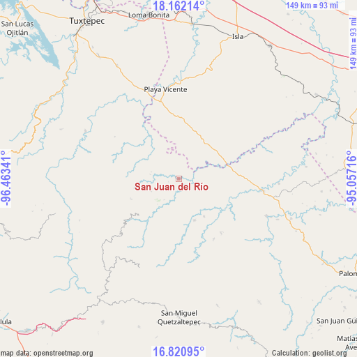
San Juan del Río GPS coordinates[2]
17° 29' 34.008" North, 95° 45' 37.008" West
| Map corner | latitude | longitude |
|---|---|---|
| Upper-left | 18.16214°, | -96.46341° |
| Center: | 17.49278°, | -95.76028° |
| Lower-right: | 16.82095°, | -95.05716° |
| Map W x H: | 149.1×149.1 km | = 92.6×92.6mi |
| max Lat: | 32.7° ⇑83.2% North |
| San Juan del Río: | 17.49278° |
| min Lat: | ⇓16.8% South 14.53588° |
| min Long | San Juan del R� | max Long |
| -117.105° | -95.76028° | -86.73105° |
| W 82.8%⇐ | ⇒17.2% E |
Elevation
Elevation of San Juan del Río is 158 m = 518 ft, and this is 1095.7 m = 3595 ft below average elevation for this country.
| Max E: |
3497 m = 11473 ft | 76.8% |
| Avg. | 1253.7 m = 4113 ft | |
| San Juan del Río | 158 m = 518 ft | |
Min E: |
-1 m = -3 ft | 23.2% |
See also: Mexico elevation on elevation.city.
Geographical zone
San Juan del Río is located in North Torrid zone (between Equator and Tropic of Cancer). Distance of this Northern Tropic circle is 660.9 km =410.7 mi to North.| Distance of | km | miles | from San Juan del Río |
|---|---|---|---|
| North Pole | 8062 | 5009.5 | to North |
| Arctic Circle | 5456.2 | 3390.3 | to North |
| Tropic Cancer | 660.9 | 410.7 | to North |
| Equator | 1945 | 1208.6 | to South |


Nearby cities:
15 places around San Juan del Río: (largest is in red/bold)
• Arroyo Blanco
12 km =7.5 mi,  296°
296°
• Arroyo Colorado (Cruz Verde)
8.8 km =5.5 mi,  53°
53°
• Arroyo de Piedra
12.9 km =8 mi,  313°
313°
• Boca del Monte
13.9 km =8.6 mi,  12°
12°
• Ignacio Zaragoza
14.9 km =9.3 mi,  288°
288°
• La Esperanza
3.3 km =2.1 mi,  351°
351°
• Montenegro la Lana
15.7 km =9.8 mi,  315°
315°
• Paso del Águila
14.2 km =8.8 mi,  65°
65°
• San Juan Jaltepec
18.7 km =11.6 mi,  146°
146°
• San Lorenzo
10.2 km =6.3 mi, 349°
• Santiago Jalahui
4.4 km =2.7 mi,  194°
194°
• Santiago Yaveo
18.7 km =11.6 mi,  159°
159°
• Santo Domingo Latani
20.1 km =12.5 mi,  228°
228°
• Tatahuicapá
14.2 km =8.8 mi,  62°
62°
• Xochiapa
19.2 km =11.9 mi, 8°
Sources, notices
• [Note1] Compared only with cities in Mexico existing in our database
• [Src1] Map data: © OpenStreetMap contributors (CC-BY-SA)
• [Src2] Other city data from geonames.org with taken over terms of usage.
• [Src3] Geographical zone / Annual Mean Temperature by Robert A. Rohde @ Wikipedia
