Lealtad de Muñoz geodata
Lealtad de Muñoz (Veracruz) is a populated place; located in Mexico in America/Mexico_City (GMT-6) time zone. With population of 776 people, there are 11259 cities with bigger population in this country. Compared to other cities in Mexico, 79.9% of cities are located further ↑North; 82.9% of cities are located further ←West and 83.5% of cities have higher elevation than Lealtad de Muñoz. Note1


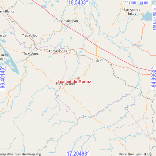
Lealtad de Muñoz GPS coordinates[2]
17° 52' 31.404" North, 95° 41' 53.952" West
| Map corner | latitude | longitude |
|---|---|---|
| Upper-left | 18.5433°, | -96.40145° |
| Center: | 17.87539°, | -95.69832° |
| Lower-right: | 17.20496°, | -94.9952° |
| Map W x H: | 148.8×148.8 km | = 92.5×92.5mi |
| max Lat: | 32.7° ⇑79.9% North |
| Lealtad de Muñoz: | 17.87539° |
| min Lat: | ⇓20.1% South 14.53588° |
| min Long | Lealtad de Muñ | max Long |
| -117.105° | -95.69832° | -86.73105° |
| W 82.9%⇐ | ⇒17.1% E |
Elevation
Elevation of Lealtad de Muñoz is 56 m = 184 ft, and this is 1197.7 m = 3929 ft below average elevation for this country.
| Max E: |
3497 m = 11473 ft | 83.5% |
| Avg. | 1253.7 m = 4113 ft | |
| Lealtad de Muñoz | 56 m = 184 ft | |
Min E: |
-1 m = -3 ft | 16.5% |
See also: Mexico elevation on elevation.city.
Geographical zone
Lealtad de Muñoz is located in North Torrid zone (between Equator and Tropic of Cancer). Distance of this Northern Tropic circle is 618.4 km =384.3 mi to North.| Distance of | km | miles | from Lealtad de Muñoz |
|---|---|---|---|
| North Pole | 8019.5 | 4983.1 | to North |
| Arctic Circle | 5413.6 | 3363.9 | to North |
| Tropic Cancer | 618.4 | 384.3 | to North |
| Equator | 1987.6 | 1235 | to South |


Nearby cities:
15 places around Lealtad de Muñoz: (largest is in red/bold)
• Abasolo del Valle
19.2 km =11.9 mi,  122°
122°
• Arenal Santa Ana
12.2 km =7.6 mi,  218°
218°
• Arroyo Zacate
19.5 km =12.1 mi,  212°
212°
• Chilapa del Carmen
15.4 km =9.6 mi,  227°
227°
• El Marcial
11.9 km =7.4 mi,  7°
7°
• El Nigromante
13.8 km =8.6 mi, 206°
• La Carlota
19.1 km =11.9 mi,  259°
259°
• La Soledad
18.8 km =11.7 mi,  267°
267°
• La Victoria
6.3 km =3.9 mi,  279°
279°
• Loma Alta
13.4 km =8.3 mi,  30°
30°
• Mixtán
17.6 km =10.9 mi, 283°
• Playa Vicente
13 km =8.1 mi,  247°
247°
• San Jerónimo
12.1 km =7.5 mi,  358°
358°
• Santa Teresa
20.2 km =12.6 mi,  172°
172°
• Totoloche
18.1 km =11.2 mi,  78°
78°
Sources, notices
• [Note1] Compared only with cities in Mexico existing in our database
• [Src1] Map data: © OpenStreetMap contributors (CC-BY-SA)
• [Src2] Other city data from geonames.org with taken over terms of usage.
• [Src3] Geographical zone / Annual Mean Temperature by Robert A. Rohde @ Wikipedia
