Loma Alta geodata
Loma Alta (Veracruz) is a populated place; located in Mexico in America/Mexico_City (GMT-6) time zone. With population of 529 people, there are 15998 cities with bigger population in this country. Compared to other cities in Mexico, 78.9% of cities are located further ↑North; 83% of cities are located further ←West and 84.1% of cities have higher elevation than Loma Alta. Note1


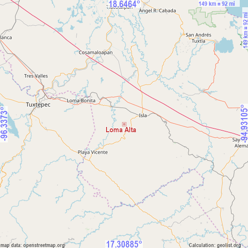
Loma Alta GPS coordinates[2]
17° 58' 44.004" North, 95° 38' 3.012" West
| Map corner | latitude | longitude |
|---|---|---|
| Upper-left | 18.6464°, | -96.3373° |
| Center: | 17.97889°, | -95.63417° |
| Lower-right: | 17.30885°, | -94.93105° |
| Map W x H: | 148.7×148.7 km | = 92.4×92.4mi |
| max Lat: | 32.7° ⇑78.9% North |
| Loma Alta: | 17.97889° |
| min Lat: | ⇓21.1% South 14.53588° |
| min Long | Loma Alta | max Long |
| -117.105° | -95.63417° | -86.73105° |
| W 83%⇐ | ⇒17% E |
Elevation
Elevation of Loma Alta is 51 m = 167 ft, and this is 1202.7 m = 3946 ft below average elevation for this country.
| Max E: |
3497 m = 11473 ft | 84.1% |
| Avg. | 1253.7 m = 4113 ft | |
| Loma Alta | 51 m = 167 ft | |
Min E: |
-1 m = -3 ft | 15.9% |
See also: Mexico elevation on elevation.city.
Geographical zone
Loma Alta is located in North Torrid zone (between Equator and Tropic of Cancer). Distance of this Northern Tropic circle is 606.9 km =377.1 mi to North.| Distance of | km | miles | from Loma Alta |
|---|---|---|---|
| North Pole | 8008 | 4975.9 | to North |
| Arctic Circle | 5402.1 | 3356.7 | to North |
| Tropic Cancer | 606.9 | 377.1 | to North |
| Equator | 1999.1 | 1242.2 | to South |


Nearby cities:
15 places around Loma Alta: (largest is in red/bold)
• Curazao
14.8 km =9.2 mi,  337°
337°
• El Maguey
12.5 km =7.8 mi,  325°
325°
• El Marcial
5.2 km =3.2 mi,  272°
272°
• El Paraíso
13.9 km =8.6 mi,  65°
65°
• Estación Dobladero
20.6 km =12.8 mi,  317°
317°
• Isla
12.3 km =7.6 mi,  63°
63°
• La Victoria
16.7 km =10.4 mi,  230°
230°
• Lealtad de Muñoz
13.4 km =8.3 mi,  210°
210°
• Lindavista
19.4 km =12.1 mi,  309°
309°
• Mazoco
10 km =6.2 mi,  13°
13°
• Nuevo Potrero
14.3 km =8.9 mi, 11°
• San Jerónimo
7.1 km =4.4 mi,  275°
275°
• Tesechoacan
17.8 km =11.1 mi,  351°
351°
• Totoloche
13.5 km =8.4 mi,  125°
125°
• Villa Azueta
13.4 km =8.3 mi, 322°
Sources, notices
• [Note1] Compared only with cities in Mexico existing in our database
• [Src1] Map data: © OpenStreetMap contributors (CC-BY-SA)
• [Src2] Other city data from geonames.org with taken over terms of usage.
• [Src3] Geographical zone / Annual Mean Temperature by Robert A. Rohde @ Wikipedia
