Totoloche geodata
Totoloche (Veracruz) is a populated place; located in Mexico in America/Mexico_City (GMT-6) time zone. With population of 582 people, there are 14734 cities with bigger population in this country. Compared to other cities in Mexico, 79.6% of cities are located further ↑North; 83.1% of cities are located further ←West and 81.6% of cities have higher elevation than Totoloche. Note1


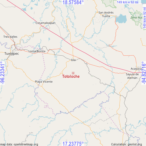
Totoloche GPS coordinates[2]
17° 54' 29.016" North, 95° 31' 49.008" West
| Map corner | latitude | longitude |
|---|---|---|
| Upper-left | 18.57584°, | -96.23341° |
| Center: | 17.90806°, | -95.53028° |
| Lower-right: | 17.23775°, | -94.82716° |
| Map W x H: | 148.8×148.8 km | = 92.5×92.5mi |
| max Lat: | 32.7° ⇑79.6% North |
| Totoloche: | 17.90806° |
| min Lat: | ⇓20.4% South 14.53588° |
| min Long | Totoloche | max Long |
| -117.105° | -95.53028° | -86.73105° |
| W 83.1%⇐ | ⇒16.9% E |
Elevation
Elevation of Totoloche is 74 m = 243 ft, and this is 1179.7 m = 3870 ft below average elevation for this country.
| Max E: |
3497 m = 11473 ft | 81.6% |
| Avg. | 1253.7 m = 4113 ft | |
| Totoloche | 74 m = 243 ft | |
Min E: |
-1 m = -3 ft | 18.4% |
See also: Mexico elevation on elevation.city.
Geographical zone
Totoloche is located in North Torrid zone (between Equator and Tropic of Cancer). Distance of this Northern Tropic circle is 614.7 km =382 mi to North.| Distance of | km | miles | from Totoloche |
|---|---|---|---|
| North Pole | 8015.9 | 4980.8 | to North |
| Arctic Circle | 5410 | 3361.6 | to North |
| Tropic Cancer | 614.7 | 382 | to North |
| Equator | 1991.2 | 1237.3 | to South |


Nearby cities:
15 places around Totoloche: (largest is in red/bold)
• Abasolo del Valle
14 km =8.7 mi,  186°
186°
• Angostura
26 km =16.2 mi,  102°
102°
• El Maguey
25.6 km =15.9 mi,  315°
315°
• El Marcial
18.1 km =11.2 mi,  296°
296°
• El Paraíso
13.7 km =8.5 mi,  7°
7°
• Isla
13.3 km =8.3 mi,  0°
0°
• Juan Rodríguez Clara
16.6 km =10.3 mi,  55°
55°
• La Unión
23 km =14.3 mi,  17°
17°
• La Victoria
24.1 km =15 mi,  263°
263°
• Lealtad de Muñoz
18.1 km =11.2 mi, 258°
• Loma Alta
13.5 km =8.4 mi,  305°
305°
• Los Tigres (San Marcos)
19.2 km =11.9 mi, 95°
• Mazoco
19.6 km =12.2 mi,  333°
333°
• Nuevo Potrero
23.4 km =14.5 mi,  339°
339°
• San Jerónimo
19.9 km =12.4 mi, 295°
Sources, notices
• [Note1] Compared only with cities in Mexico existing in our database
• [Src1] Map data: © OpenStreetMap contributors (CC-BY-SA)
• [Src2] Other city data from geonames.org with taken over terms of usage.
• [Src3] Geographical zone / Annual Mean Temperature by Robert A. Rohde @ Wikipedia
