Congregación Calles geodata
Congregación Calles (Nuevo León) is a populated place; located in Mexico in America/Monterrey (GMT-6) time zone. With population of 1,142 people, there are 7607 cities with bigger population in this country. Compared to other cities in Mexico, 92.1% of cities are located further ↓South; 63.1% of cities are located further →East and 69.3% of cities have higher elevation than Congregación Calles. Note1


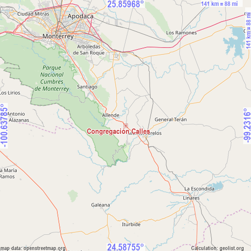
Congregación Calles GPS coordinates[2]
25° 13' 31.008" North, 99° 56' 4.992" West
| Map corner | latitude | longitude |
|---|---|---|
| Upper-left | 25.85968°, | -100.63785° |
| Center: | 25.22528°, | -99.93472° |
| Lower-right: | 24.58755°, | -99.2316° |
| Map W x H: | 141.4×141.4 km | = 87.9×87.9mi |
| max Lat: | 32.7° ⇑7.9% North |
| Congregación Calles: | 25.22528° |
| min Lat: | ⇓92.1% South 14.53588° |
| min Long | Congregación C | max Long |
| -117.105° | -99.93472° | -86.73105° |
| W 36.9%⇐ | ⇒63.1% E |
Elevation
Elevation of Congregación Calles is 453 m = 1486 ft, and this is 800.7 m = 2627 ft below average elevation for this country.
| Max E: |
3497 m = 11473 ft | 69.3% |
| Avg. | 1253.7 m = 4113 ft | |
| Congregación Calles | 453 m = 1486 ft | |
Min E: |
-1 m = -3 ft | 30.7% |
See also: Mexico elevation on elevation.city.
Geographical zone
Congregación Calles is located in North temperate zone (between Tropic of Cancer and the Arctic Circle). Distance of this Northern Tropic circle is 198.9 km =123.6 mi to South.| Distance of | km | miles | from Congregación Calles |
|---|---|---|---|
| North Pole | 7202.3 | 4475.3 | to North |
| Arctic Circle | 4596.4 | 2856.1 | to North |
| Tropic Cancer | 198.9 | 123.6 | to South |
| Equator | 2804.8 | 1742.8 | to South |


Nearby cities:
15 places around Congregación Calles: (largest is in red/bold)
• Atongo de Abajo
15.8 km =9.8 mi,  340°
340°
• Cadereyta
40.1 km =24.9 mi,  353°
353°
• Cadereyta Jiménez
41 km =25.5 mi, 350°
• Ciudad General Terán
25.5 km =15.8 mi,  81°
81°
• Ciudad de Allende
9.8 km =6.1 mi,  305°
305°
• Dieciséis de Septiembre
46.1 km =28.6 mi,  332°
332°
• El Fraile
14.7 km =9.1 mi,  0°
0°
• Mazatlan
11.4 km =7.1 mi,  110°
110°
• Palmitos
26.7 km =16.6 mi, 352°
• Paso Hondo
7.1 km =4.4 mi, 331°
• Pueblo Nuevo
33.7 km =20.9 mi,  31°
31°
• Rayones
27 km =16.8 mi,  211°
211°
• San Juan
36.5 km =22.7 mi,  14°
14°
• Santa Isabel y Dolores
38 km =23.6 mi,  24°
24°
• Santiago
31.2 km =19.4 mi,  315°
315°
Sources, notices
• [Note1] Compared only with cities in Mexico existing in our database
• [Src1] Map data: © OpenStreetMap contributors (CC-BY-SA)
• [Src2] Other city data from geonames.org with taken over terms of usage.
• [Src3] Geographical zone / Annual Mean Temperature by Robert A. Rohde @ Wikipedia
