Ahuacatlán de Guadalupe geodata
Ahuacatlán de Guadalupe (Querétaro) is a populated place; located in Mexico in America/Mexico_City (GMT-6) time zone. With population of 1,815 people, there are 4798 cities with bigger population in this country. Compared to other cities in Mexico, 79.3% of cities are located further ↓South; 57.5% of cities are located further →East and 57.4% of cities have higher elevation than Ahuacatlán de Guadalupe. Note1
Current local time in Ahuacatlán de Guadalupe:
11:15 AM, MondayDifference from your time zone: hours


Ahuacatlán de Guadalupe GPS coordinates[2]
21° 12' 52.992" North, 99° 32' 26.016" West
| Map corner | latitude | longitude |
|---|---|---|
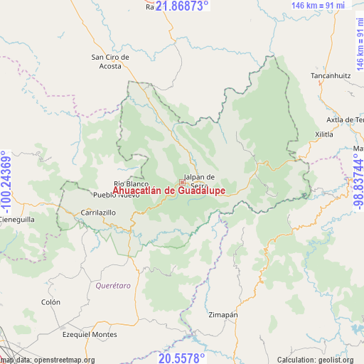
| Upper-left | 21.86873°, | -100.24369° |
| Center: | 21.21472°, | -99.54056° |
| Lower-right: | 20.5578°, | -98.83744° |
| Map W x H: | 145.8×145.8 km | = 90.6×90.6mi |
| max Lat: | 32.7° ⇑20.7% North |
| Ahuacatlán de Guadalupe: | 21.21472° |
| min Lat: | ⇓79.3% South 14.53588° |
| min Long | Ahuacatlán de | max Long |
| -117.105° | -99.54056° | -86.73105° |
| W 42.5%⇐ | ⇒57.5% E |
Elevation
Elevation of Ahuacatlán de Guadalupe is 1115 m = 3658 ft, and this is 138.7 m = 455 ft below average elevation for this country.
| Max E: |
3497 m = 11473 ft | 57.4% |
| Avg. | 1253.7 m = 4113 ft | |
| Ahuacatlán de Guadalupe | 1115 m = 3658 ft | |
Min E: |
-1 m = -3 ft | 42.6% |
See also: Mexico elevation on elevation.city.
Geographical zone
Ahuacatlán de Guadalupe is located in North Torrid zone (between Equator and Tropic of Cancer). Distance of this Northern Tropic circle is 247.1 km =153.5 mi to North.| Distance of | km | miles | from Ahuacatlán de Guadalupe |
|---|---|---|---|
| North Pole | 7648.2 | 4752.4 | to North |
| Arctic Circle | 5042.3 | 3133.1 | to North |
| Tropic Cancer | 247.1 | 153.5 | to North |
| Equator | 2358.9 | 1465.8 | to South |


Nearby cities:
15 places around Ahuacatlán de Guadalupe: (largest is in red/bold)
• Agua Fría
28.4 km =17.6 mi,  256°
256°
• Atarjea
19.4 km =12.1 mi,  287°
287°
• Camargo
23.4 km =14.5 mi,  238°
238°
• Concá
27.4 km =17 mi,  338°
338°
• El Lindero
8.2 km =5.1 mi,  29°
29°
• Encino Solo
28.8 km =17.9 mi,  81°
81°
• Jalpan
7.2 km =4.5 mi,  87°
87°
• La Estación
29.5 km =18.3 mi,  225°
225°
• La Lagunita
29.4 km =18.3 mi, 82°
• Landa de Matamoros
23.1 km =14.4 mi,  98°
98°
• Peña Blanca
27.8 km =17.3 mi, 225°
• Pinal de Amoles
12.6 km =7.8 mi,  224°
224°
• Purísima de Arista
11.1 km =6.9 mi,  15°
15°
• Sauz de Guadalupe
7.6 km =4.7 mi, 289°
• Vicente Guerrero
29.9 km =18.6 mi,  127°
127°
Sources, notices
• [Note1] Compared only with cities in Mexico existing in our database
• [Src1] Map data: © OpenStreetMap contributors (CC-BY-SA)
• [Src2] Other city data from geonames.org with taken over terms of usage.
• [Src3] Geographical zone / Annual Mean Temperature by Robert A. Rohde @ Wikipedia
