Bajos de Chila geodata
Bajos de Chila (Oaxaca) is a populated place; located in Mexico in America/Mexico_City (GMT-6) time zone. With population of 5,425 people, there are 1710 cities with bigger population in this country. Compared to other cities in Mexico, 97.5% of cities are located further ↑North; 73.3% of cities are located further ←West and 90% of cities have higher elevation than Bajos de Chila. Note1


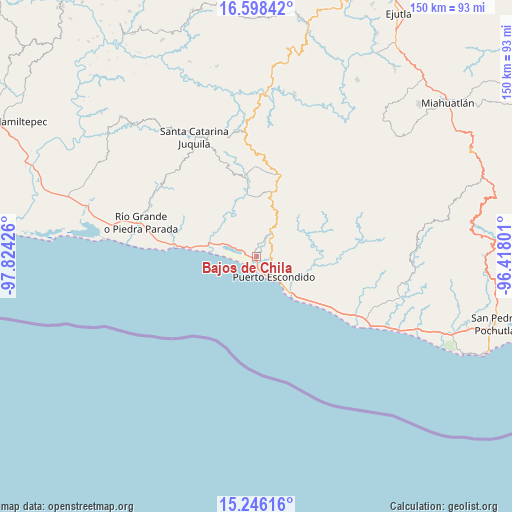
Bajos de Chila GPS coordinates[2]
15° 55' 24.348" North, 97° 7' 16.068" West
| Map corner | latitude | longitude |
|---|---|---|
| Upper-left | 16.59842°, | -97.82426° |
| Center: | 15.92343°, | -97.12113° |
| Lower-right: | 15.24616°, | -96.41801° |
| Map W x H: | 150.4×150.4 km | = 93.5×93.5mi |
| max Lat: | 32.7° ⇑97.5% North |
| Bajos de Chila: | 15.92343° |
| min Lat: | ⇓2.5% South 14.53588° |
| min Long | Bajos de Chila | max Long |
| -117.105° | -97.12113° | -86.73105° |
| W 73.3%⇐ | ⇒26.7% E |
Elevation
Elevation of Bajos de Chila is 24 m = 79 ft, and this is 1229.7 m = 4034 ft below average elevation for this country.
| Max E: |
3497 m = 11473 ft | 90% |
| Avg. | 1253.7 m = 4113 ft | |
| Bajos de Chila | 24 m = 79 ft | |
Min E: |
-1 m = -3 ft | 10% |
See also: Mexico elevation on elevation.city.
Geographical zone
Bajos de Chila is located in North Torrid zone (between Equator and Tropic of Cancer). Distance of this Northern Tropic circle is 835.4 km =519.1 mi to North.| Distance of | km | miles | from Bajos de Chila |
|---|---|---|---|
| North Pole | 8236.5 | 5117.9 | to North |
| Arctic Circle | 5630.7 | 3498.8 | to North |
| Tropic Cancer | 835.4 | 519.1 | to North |
| Equator | 1770.5 | 1100.1 | to South |


Nearby cities:
15 places around Bajos de Chila: (largest is in red/bold)
• Barra de Navidad
15.5 km =9.6 mi,  136°
136°
• Brisas de Zicatela
12.8 km =8 mi, 138°
• Colonia Libertad
9.2 km =5.7 mi,  131°
131°
• El Huarumbo
8.5 km =5.3 mi,  26°
26°
• Hidalgo Manialtepec
14.7 km =9.1 mi,  285°
285°
• La Barra de Colotepec
14.7 km =9.1 mi, 137°
• La Reforma
16.4 km =10.2 mi,  64°
64°
• Puerto Escondido
7.5 km =4.7 mi, 141°
• San Andrés Copala
8.8 km =5.5 mi,  343°
343°
• San Gabriel Mixtepec
19.6 km =12.2 mi,  12°
12°
• San José Manialtepec
14.3 km =8.9 mi, 293°
• San Pedro Mixtepec
7.9 km =4.9 mi, 34°
• Santa María Colotepec
19.6 km =12.2 mi,  98°
98°
• Santa María Tiltepec
16.4 km =10.2 mi, 341°
• Santiago Cuixtla
16.9 km =10.5 mi, 335°
Sources, notices
• [Note1] Compared only with cities in Mexico existing in our database
• [Src1] Map data: © OpenStreetMap contributors (CC-BY-SA)
• [Src2] Other city data from geonames.org with taken over terms of usage.
• [Src3] Geographical zone / Annual Mean Temperature by Robert A. Rohde @ Wikipedia
