San Vicente Piñas geodata
San Vicente Piñas (Oaxaca) is a populated place; located in Mexico in America/Mexico_City (GMT-6) time zone. With population of 1,003 people, there are 8693 cities with bigger population in this country. Compared to other cities in Mexico, 91.9% of cities are located further ↑North; 62.9% of cities are located further ←West and 66.7% of cities have higher elevation than San Vicente Piñas. Note1


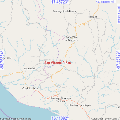
San Vicente Piñas GPS coordinates[2]
16° 47' 6.972" North, 98° 3' 37.476" West
| Map corner | latitude | longitude |
|---|---|---|
| Upper-left | 17.45723°, | -98.76354° |
| Center: | 16.78527°, | -98.06041° |
| Lower-right: | 16.11092°, | -97.35729° |
| Map W x H: | 149.7×149.7 km | = 93×93mi |
| max Lat: | 32.7° ⇑91.9% North |
| San Vicente Piñas: | 16.78527° |
| min Lat: | ⇓8.1% South 14.53588° |
| min Long | San Vicente Pi� | max Long |
| -117.105° | -98.06041° | -86.73105° |
| W 62.9%⇐ | ⇒37.1% E |
Elevation
Elevation of San Vicente Piñas is 600 m = 1969 ft, and this is 653.7 m = 2145 ft below average elevation for this country.
| Max E: |
3497 m = 11473 ft | 66.7% |
| Avg. | 1253.7 m = 4113 ft | |
| San Vicente Piñas | 600 m = 1969 ft | |
Min E: |
-1 m = -3 ft | 33.3% |
See also: Mexico elevation on elevation.city.
Geographical zone
San Vicente Piñas is located in North Torrid zone (between Equator and Tropic of Cancer). Distance of this Northern Tropic circle is 739.6 km =459.6 mi to North.| Distance of | km | miles | from San Vicente Piñas |
|---|---|---|---|
| North Pole | 8140.7 | 5058.4 | to North |
| Arctic Circle | 5534.8 | 3439.2 | to North |
| Tropic Cancer | 739.6 | 459.6 | to North |
| Equator | 1866.3 | 1159.7 | to South |


Nearby cities:
15 places around San Vicente Piñas: (largest is in red/bold)
• Aquiles Serdán
10.3 km =6.4 mi,  49°
49°
• Arroyo Gente
15.9 km =9.9 mi,  247°
247°
• Colonia Renacimiento
13.2 km =8.2 mi,  259°
259°
• Concepción las Mesas
15 km =9.3 mi, 45°
• El Rosario
12.3 km =7.6 mi, 45°
• El Santiago
15.7 km =9.8 mi, 259°
• El Tapanco
7.7 km =4.8 mi,  64°
64°
• Guadalupe Victoria
13.3 km =8.3 mi, 255°
• La Guadalupe
12.3 km =7.6 mi,  188°
188°
• Plan de Pierna
15 km =9.3 mi,  265°
265°
• San José de las Flores
14.3 km =8.9 mi,  5°
5°
• San Pedro Amuzgos
15 km =9.3 mi, 192°
• Santa Cruz Tutiahua
16 km =9.9 mi,  96°
96°
• Santa María Ipalapa
16.5 km =10.3 mi,  169°
169°
• Santa María Zacatepec
7.8 km =4.8 mi,  107°
107°
Sources, notices
• [Note1] Compared only with cities in Mexico existing in our database
• [Src1] Map data: © OpenStreetMap contributors (CC-BY-SA)
• [Src2] Other city data from geonames.org with taken over terms of usage.
• [Src3] Geographical zone / Annual Mean Temperature by Robert A. Rohde @ Wikipedia
