Río Metates geodata
Río Metates (Oaxaca) is a populated place; located in Mexico in America/Mexico_City (GMT-6) time zone. With population of 519 people, there are 16226 cities with bigger population in this country. Compared to other cities in Mexico, 87.5% of cities are located further ↑North; 63.8% of cities are located further ←West and 56.9% of cities have higher elevation than Río Metates. Note1


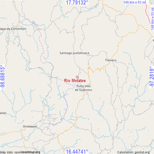
Río Metates GPS coordinates[2]
17° 7' 14.088" North, 97° 59' 6.072" West
| Map corner | latitude | longitude |
|---|---|---|
| Upper-left | 17.79132°, | -98.68815° |
| Center: | 17.12058°, | -97.98502° |
| Lower-right: | 16.44741°, | -97.2819° |
| Map W x H: | 149.4×149.4 km | = 92.8×92.8mi |
| max Lat: | 32.7° ⇑87.5% North |
| Río Metates: | 17.12058° |
| min Lat: | ⇓12.5% South 14.53588° |
| min Long | Río Metates | max Long |
| -117.105° | -97.98502° | -86.73105° |
| W 63.8%⇐ | ⇒36.2% E |
Elevation
Elevation of Río Metates is 1124 m = 3688 ft, and this is 129.7 m = 426 ft below average elevation for this country.
| Max E: |
3497 m = 11473 ft | 56.9% |
| Avg. | 1253.7 m = 4113 ft | |
| Río Metates | 1124 m = 3688 ft | |
Min E: |
-1 m = -3 ft | 43.1% |
See also: Mexico elevation on elevation.city.
Geographical zone
Río Metates is located in North Torrid zone (between Equator and Tropic of Cancer). Distance of this Northern Tropic circle is 702.3 km =436.4 mi to North.| Distance of | km | miles | from Río Metates |
|---|---|---|---|
| North Pole | 8103.4 | 5035.2 | to North |
| Arctic Circle | 5497.5 | 3416 | to North |
| Tropic Cancer | 702.3 | 436.4 | to North |
| Equator | 1903.6 | 1182.8 | to South |


Nearby cities:
15 places around Río Metates: (largest is in red/bold)
• Concepción Carrizal
10.5 km =6.5 mi,  68°
68°
• Concepción del Progreso
15.4 km =9.6 mi,  122°
122°
• Constancia del Rosario
10.3 km =6.4 mi,  153°
153°
• El Rastrojo
5.1 km =3.2 mi,  35°
35°
• La Sabana
8.9 km =5.5 mi,  17°
17°
• Malpica
14.5 km =9 mi, 146°
• Putla Villa de Guerrero
12.1 km =7.5 mi, 150°
• San Juan Copala
7.7 km =4.8 mi, 17°
• San Juan Lagunas
14.9 km =9.3 mi,  157°
157°
• San Miguel Copala
8.9 km =5.5 mi,  137°
137°
• Santa Cruz Yucucani
14.5 km =9 mi,  250°
250°
• Santa María Asunción
13.6 km =8.5 mi,  353°
353°
• Santa María Yucunicoco
14.9 km =9.3 mi,  29°
29°
• Santo Domingo del Estado
15.1 km =9.4 mi, 74°
• Tierra Blanca
8.5 km =5.3 mi, 67°
Sources, notices
• [Note1] Compared only with cities in Mexico existing in our database
• [Src1] Map data: © OpenStreetMap contributors (CC-BY-SA)
• [Src2] Other city data from geonames.org with taken over terms of usage.
• [Src3] Geographical zone / Annual Mean Temperature by Robert A. Rohde @ Wikipedia
