Putla Villa de Guerrero geodata
Putla Villa de Guerrero (Oaxaca) is a seat of a second-order administrative division; located in Mexico in America/Mexico_City (GMT-6) time zone. With population of 10,925 people, there are 872 cities with bigger population in this country. Compared to other cities in Mexico, 88.6% of cities are located further ↑North; 64.5% of cities are located further ←West and 64.1% of cities have higher elevation than Putla Villa de Guerrero. Note1
Current local time in Putla Villa de Guerrero:
06:54 AM, WednesdayDifference from your time zone: hours


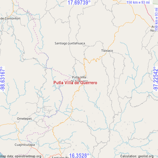
Putla Villa de Guerrero GPS coordinates[2]
17° 1' 34.68" North, 97° 55' 42.744" West
| Map corner | latitude | longitude |
|---|---|---|
| Upper-left | 17.69739°, | -98.63167° |
| Center: | 17.0263°, | -97.92854° |
| Lower-right: | 16.3528°, | -97.22542° |
| Map W x H: | 149.5×149.5 km | = 92.9×92.9mi |
| max Lat: | 32.7° ⇑88.6% North |
| Putla Villa de Guerrero: | 17.0263° |
| min Lat: | ⇓11.4% South 14.53588° |
| min Long | Putla Villa de | max Long |
| -117.105° | -97.92854° | -86.73105° |
| W 64.5%⇐ | ⇒35.5% E |
Elevation
Elevation of Putla Villa de Guerrero is 747 m = 2451 ft, and this is 506.7 m = 1662 ft below average elevation for this country.
| Max E: |
3497 m = 11473 ft | 64.1% |
| Avg. | 1253.7 m = 4113 ft | |
| Putla Villa de Guerrero | 747 m = 2451 ft | |
Min E: |
-1 m = -3 ft | 35.9% |
See also: Mexico elevation on elevation.city.
Geographical zone
Putla Villa de Guerrero is located in North Torrid zone (between Equator and Tropic of Cancer). Distance of this Northern Tropic circle is 712.8 km =442.9 mi to North.| Distance of | km | miles | from Putla Villa de Guerrero |
|---|---|---|---|
| North Pole | 8113.9 | 5041.7 | to North |
| Arctic Circle | 5508 | 3422.5 | to North |
| Tropic Cancer | 712.8 | 442.9 | to North |
| Equator | 1893.1 | 1176.3 | to South |


Nearby cities:
15 places around Putla Villa de Guerrero: (largest is in red/bold)
• Concepción Carrizal
14.8 km =9.2 mi,  15°
15°
• Concepción del Progreso
7.4 km =4.6 mi,  72°
72°
• Constancia del Rosario
1.9 km =1.2 mi,  314°
314°
• El Rastrojo
14.9 km =9.3 mi,  348°
348°
• La Zafra
6.3 km =3.9 mi,  136°
136°
• Malpica
2.6 km =1.6 mi,  127°
127°
• Miramar
14.1 km =8.8 mi,  101°
101°
• Río Metates
12.1 km =7.5 mi,  330°
330°
• San Juan Lagunas
3.2 km =2 mi,  184°
184°
• San Juan Teponaxtla
7.7 km =4.8 mi,  85°
85°
• San Miguel Copala
3.9 km =2.4 mi,  358°
358°
• San Miguel Reyes
12.3 km =7.6 mi,  162°
162°
• San Pedro Siniyuvi
10.4 km =6.5 mi,  116°
116°
• Tierra Blanca
13.9 km =8.6 mi,  7°
7°
• Zimatlán
14.2 km =8.8 mi, 133°
Sources, notices
• [Note1] Compared only with cities in Mexico existing in our database
• [Src1] Map data: © OpenStreetMap contributors (CC-BY-SA)
• [Src2] Other city data from geonames.org with taken over terms of usage.
• [Src3] Geographical zone / Annual Mean Temperature by Robert A. Rohde @ Wikipedia
