San Juan Lagunas geodata
San Juan Lagunas (Oaxaca) is a populated place; located in Mexico in America/Mexico_City (GMT-6) time zone. With population of 1,446 people, there are 5968 cities with bigger population in this country. Compared to other cities in Mexico, 88.9% of cities are located further ↑North; 64.4% of cities are located further ←West and 63.9% of cities have higher elevation than San Juan Lagunas. Note1


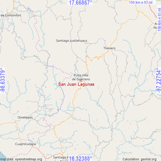
San Juan Lagunas GPS coordinates[2]
16° 59' 50.928" North, 97° 55' 50.376" West
| Map corner | latitude | longitude |
|---|---|---|
| Upper-left | 17.66867°, | -98.63379° |
| Center: | 16.99748°, | -97.93066° |
| Lower-right: | 16.32388°, | -97.22754° |
| Map W x H: | 149.5×149.5 km | = 92.9×92.9mi |
| max Lat: | 32.7° ⇑88.9% North |
| San Juan Lagunas: | 16.99748° |
| min Lat: | ⇓11.1% South 14.53588° |
| min Long | San Juan Laguna | max Long |
| -117.105° | -97.93066° | -86.73105° |
| W 64.4%⇐ | ⇒35.6% E |
Elevation
Elevation of San Juan Lagunas is 754 m = 2474 ft, and this is 499.7 m = 1639 ft below average elevation for this country.
| Max E: |
3497 m = 11473 ft | 63.9% |
| Avg. | 1253.7 m = 4113 ft | |
| San Juan Lagunas | 754 m = 2474 ft | |
Min E: |
-1 m = -3 ft | 36.1% |
See also: Mexico elevation on elevation.city.
Geographical zone
San Juan Lagunas is located in North Torrid zone (between Equator and Tropic of Cancer). Distance of this Northern Tropic circle is 716 km =444.9 mi to North.| Distance of | km | miles | from San Juan Lagunas |
|---|---|---|---|
| North Pole | 8117.1 | 5043.7 | to North |
| Arctic Circle | 5511.2 | 3424.5 | to North |
| Tropic Cancer | 716 | 444.9 | to North |
| Equator | 1889.9 | 1174.3 | to South |


Nearby cities:
15 places around San Juan Lagunas: (largest is in red/bold)
• Concepción del Progreso
9.1 km =5.7 mi,  53°
53°
• Concepción las Mesas
13.4 km =8.3 mi,  193°
193°
• Constancia del Rosario
4.7 km =2.9 mi,  346°
346°
• El Rosario
15.8 km =9.8 mi,  198°
198°
• La Zafra
4.7 km =2.9 mi,  107°
107°
• Malpica
2.8 km =1.7 mi, 54°
• Miramar
14 km =8.7 mi,  88°
88°
• Putla Villa de Guerrero
3.2 km =2 mi,  4°
4°
• Río Metates
14.9 km =9.3 mi,  337°
337°
• San José de las Flores
15.4 km =9.6 mi,  232°
232°
• San Juan Teponaxtla
8.7 km =5.4 mi,  64°
64°
• San Miguel Copala
7.1 km =4.4 mi, 1°
• San Miguel Reyes
9.4 km =5.8 mi,  154°
154°
• San Pedro Siniyuvi
9.7 km =6 mi,  98°
98°
• Zimatlán
12.4 km =7.7 mi,  122°
122°
Sources, notices
• [Note1] Compared only with cities in Mexico existing in our database
• [Src1] Map data: © OpenStreetMap contributors (CC-BY-SA)
• [Src2] Other city data from geonames.org with taken over terms of usage.
• [Src3] Geographical zone / Annual Mean Temperature by Robert A. Rohde @ Wikipedia
