Guadalupe Nogales geodata
Guadalupe Nogales (Guerrero) is a populated place; located in Mexico in America/Mexico_City (GMT-6) time zone. With population of 697 people, there are 12494 cities with bigger population in this country. Compared to other cities in Mexico, 83.3% of cities are located further ↑North; 59.7% of cities are located further ←West and 70.1% of cities have lower elevation than Guadalupe Nogales. Note1


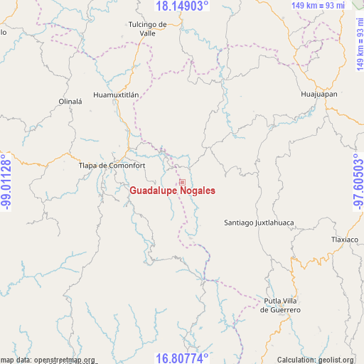
Guadalupe Nogales GPS coordinates[2]
17° 28' 46.632" North, 98° 18' 29.34" West
| Map corner | latitude | longitude |
|---|---|---|
| Upper-left | 18.14903°, | -99.01128° |
| Center: | 17.47962°, | -98.30815° |
| Lower-right: | 16.80774°, | -97.60503° |
| Map W x H: | 149.1×149.1 km | = 92.6×92.6mi |
| max Lat: | 32.7° ⇑83.3% North |
| Guadalupe Nogales: | 17.47962° |
| min Lat: | ⇓16.7% South 14.53588° |
| min Long | Guadalupe Nogal | max Long |
| -117.105° | -98.30815° | -86.73105° |
| W 59.7%⇐ | ⇒40.3% E |
Elevation
Elevation of Guadalupe Nogales is 1925 m = 6316 ft, and this is 671.3 m = 2202 ft above average elevation for this country.
| Max E: |
3497 m = 11473 ft | 29.9% |
| Guadalupe Nogales | 1925 m 6316 ft | |
| Avg. | 1253.7 m = 4113 ft | |
Min E: |
-1 m = -3 ft | 70.1% |
See also: Mexico elevation on elevation.city.
Geographical zone
Guadalupe Nogales is located in North Torrid zone (between Equator and Tropic of Cancer). Distance of this Northern Tropic circle is 662.4 km =411.6 mi to North.| Distance of | km | miles | from Guadalupe Nogales |
|---|---|---|---|
| North Pole | 8063.5 | 5010.4 | to North |
| Arctic Circle | 5457.6 | 3391.2 | to North |
| Tropic Cancer | 662.4 | 411.6 | to North |
| Equator | 1943.6 | 1207.7 | to South |


Nearby cities:
15 places around Guadalupe Nogales: (largest is in red/bold)
• Ahuajutla
5.8 km =3.6 mi,  160°
160°
• Alcozauca de Guerrero
8.2 km =5.1 mi,  258°
258°
• Almolonga de Ocampo (Almolonga)
8.2 km =5.1 mi,  216°
216°
• Calihualá
6.6 km =4.1 mi,  29°
29°
• Cuyuxtlahuaca
3.9 km =2.4 mi,  274°
274°
• La Luz de Juárez
7.5 km =4.7 mi,  325°
325°
• San Francisco Tlapancingo
4.3 km =2.7 mi,  84°
84°
• San Martín Peras
15.4 km =9.6 mi,  150°
150°
• Santa Cruz
11.7 km =7.3 mi,  300°
300°
• Santa Cruz de Bravo
14.4 km =8.9 mi,  38°
38°
• Silacayoápam
18.1 km =11.2 mi, 81°
• Tlachichilco
16.3 km =10.1 mi,  346°
346°
• Tlahuapa
12 km =7.5 mi,  194°
194°
• Tlalixtaquilla
12.5 km =7.8 mi, 329°
• Xonacatlán
11.3 km =7 mi,  282°
282°
Sources, notices
• [Note1] Compared only with cities in Mexico existing in our database
• [Src1] Map data: © OpenStreetMap contributors (CC-BY-SA)
• [Src2] Other city data from geonames.org with taken over terms of usage.
• [Src3] Geographical zone / Annual Mean Temperature by Robert A. Rohde @ Wikipedia
