Villa Nueva geodata
Villa Nueva (Oaxaca) is a populated place; located in Mexico in America/Mexico_City (GMT-6) time zone. With population of 544 people, there are 15626 cities with bigger population in this country. Compared to other cities in Mexico, 76.5% of cities are located further ↑North; 75.1% of cities are located further ←West and 74.4% of cities have lower elevation than Villa Nueva. Note1


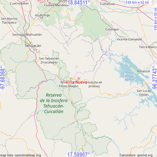
Villa Nueva GPS coordinates[2]
18° 10' 42.132" North, 96° 58' 49.98" West
| Map corner | latitude | longitude |
|---|---|---|
| Upper-left | 18.84511°, | -97.68368° |
| Center: | 18.17837°, | -96.98055° |
| Lower-right: | 17.50907°, | -96.27743° |
| Map W x H: | 148.6×148.6 km | = 92.3×92.3mi |
| max Lat: | 32.7° ⇑76.5% North |
| Villa Nueva: | 18.17837° |
| min Lat: | ⇓23.5% South 14.53588° |
| min Long | Villa Nueva | max Long |
| -117.105° | -96.98055° | -86.73105° |
| W 75.1%⇐ | ⇒24.9% E |
Elevation
Elevation of Villa Nueva is 2020 m = 6627 ft, and this is 766.3 m = 2514 ft above average elevation for this country.
| Max E: |
3497 m = 11473 ft | 25.6% |
| Villa Nueva | 2020 m 6627 ft | |
| Avg. | 1253.7 m = 4113 ft | |
Min E: |
-1 m = -3 ft | 74.4% |
See also: Mexico elevation on elevation.city.
Geographical zone
Villa Nueva is located in North Torrid zone (between Equator and Tropic of Cancer). Distance of this Northern Tropic circle is 584.7 km =363.3 mi to North.| Distance of | km | miles | from Villa Nueva |
|---|---|---|---|
| North Pole | 7985.8 | 4962.1 | to North |
| Arctic Circle | 5379.9 | 3342.9 | to North |
| Tropic Cancer | 584.7 | 363.3 | to North |
| Equator | 2021.2 | 1255.9 | to South |


Nearby cities:
15 places around Villa Nueva: (largest is in red/bold)
• El Duraznillo
7.4 km =4.6 mi,  182°
182°
• Huehuetlán Segunda Sección
4.3 km =2.7 mi,  65°
65°
• Los Frailes
9 km =5.6 mi,  158°
158°
• San Francisco Huehuetlán
4 km =2.5 mi,  58°
58°
• San Isidro Zoquiápam
10.7 km =6.6 mi,  147°
147°
• San Jerónimo Tecóatl
7.3 km =4.5 mi,  100°
100°
• San Juan Cuautla
7.7 km =4.8 mi,  18°
18°
• San Lorenzo Cuaunecuiltitla
7.8 km =4.8 mi, 66°
• San Lucas Zoquiápam
9.2 km =5.7 mi,  120°
120°
• San Pedro Ocopetatillo
7.3 km =4.5 mi,  83°
83°
• Santa María Teopoxco
3 km =1.9 mi, 115°
• Santiago Texcalcingo
3.6 km =2.2 mi, 20°
• Tecuanapam
2.8 km =1.7 mi,  130°
130°
• Tepantitlán
3.2 km =2 mi,  352°
352°
• Tepoxtla
7.2 km =4.5 mi, 349°
Sources, notices
• [Note1] Compared only with cities in Mexico existing in our database
• [Src1] Map data: © OpenStreetMap contributors (CC-BY-SA)
• [Src2] Other city data from geonames.org with taken over terms of usage.
• [Src3] Geographical zone / Annual Mean Temperature by Robert A. Rohde @ Wikipedia
