San Pedro Ocopetatillo geodata
San Pedro Ocopetatillo (Oaxaca) is a seat of a second-order administrative division; located in Mexico in America/Mexico_City (GMT-6) time zone. With population of 884 people, there are 9870 cities with bigger population in this country. Compared to other cities in Mexico, 76.4% of cities are located further ↑North; 76% of cities are located further ←West and 62.7% of cities have lower elevation than San Pedro Ocopetatillo. Note1
Current local time in San Pedro Ocopetatillo:
08:35 AM, WednesdayDifference from your time zone: hours


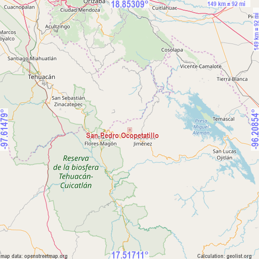
San Pedro Ocopetatillo GPS coordinates[2]
18° 11' 10.968" North, 96° 54' 41.976" West
| Map corner | latitude | longitude |
|---|---|---|
| Upper-left | 18.85309°, | -97.61479° |
| Center: | 18.18638°, | -96.91166° |
| Lower-right: | 17.51711°, | -96.20854° |
| Map W x H: | 148.5×148.5 km | = 92.3×92.3mi |
| max Lat: | 32.7° ⇑76.4% North |
| San Pedro Ocopetatillo: | 18.18638° |
| min Lat: | ⇓23.6% South 14.53588° |
| min Long | San Pedro Ocope | max Long |
| -117.105° | -96.91166° | -86.73105° |
| W 76%⇐ | ⇒24% E |
Elevation
Elevation of San Pedro Ocopetatillo is 1772 m = 5814 ft, and this is 518.3 m = 1700 ft above average elevation for this country.
| Max E: |
3497 m = 11473 ft | 37.3% |
| San Pedro Ocopetatillo | 1772 m 5814 ft | |
| Avg. | 1253.7 m = 4113 ft | |
Min E: |
-1 m = -3 ft | 62.7% |
See also: Mexico elevation on elevation.city.
Geographical zone
San Pedro Ocopetatillo is located in North Torrid zone (between Equator and Tropic of Cancer). Distance of this Northern Tropic circle is 583.8 km =362.8 mi to North.| Distance of | km | miles | from San Pedro Ocopetatillo |
|---|---|---|---|
| North Pole | 7984.9 | 4961.6 | to North |
| Arctic Circle | 5379 | 3342.4 | to North |
| Tropic Cancer | 583.8 | 362.8 | to North |
| Equator | 2022.1 | 1256.5 | to South |


Nearby cities:
15 places around San Pedro Ocopetatillo: (largest is in red/bold)
• Eloxochitlán de Flores Magón
4 km =2.5 mi,  104°
104°
• Huehuetlán Segunda Sección
3.5 km =2.2 mi,  284°
284°
• La Reforma San Mateo
7.5 km =4.7 mi,  143°
143°
• San Francisco Huehuetlán
4 km =2.5 mi,  287°
287°
• San Jerónimo Tecóatl
2.2 km =1.4 mi,  182°
182°
• San Juan Cuautla
8 km =5 mi,  323°
323°
• San Lorenzo Cuaunecuiltitla
2.3 km =1.4 mi,  356°
356°
• San Lucas Zoquiápam
5.6 km =3.5 mi,  173°
173°
• San Mateo Yoloxochitlán
6.6 km =4.1 mi, 136°
• Santa Cruz Acatepec
4.6 km =2.9 mi,  123°
123°
• Santa María Teopoxco
5.1 km =3.2 mi,  244°
244°
• Santiago Texcalcingo
6.5 km =4 mi, 292°
• Tecuanapam
5.8 km =3.6 mi, 242°
• Tepantitlán
8 km =5 mi, 286°
• Villa Nueva
7.3 km =4.5 mi,  263°
263°
Sources, notices
• [Note1] Compared only with cities in Mexico existing in our database
• [Src1] Map data: © OpenStreetMap contributors (CC-BY-SA)
• [Src2] Other city data from geonames.org with taken over terms of usage.
• [Src3] Geographical zone / Annual Mean Temperature by Robert A. Rohde @ Wikipedia
