El Duraznillo geodata
El Duraznillo (Oaxaca) is a populated place; located in Mexico in America/Mexico_City (GMT-6) time zone. With population of 549 people, there are 15509 cities with bigger population in this country. Compared to other cities in Mexico, 77.4% of cities are located further ↑North; 75% of cities are located further ←West and 84.8% of cities have lower elevation than El Duraznillo. Note1


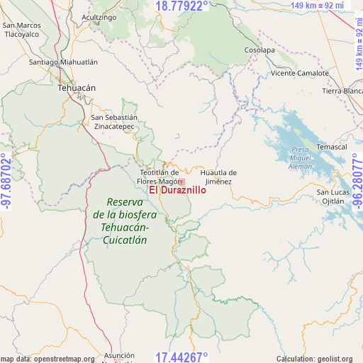
El Duraznillo GPS coordinates[2]
18° 6' 43.992" North, 96° 59' 2.004" West
| Map corner | latitude | longitude |
|---|---|---|
| Upper-left | 18.77922°, | -97.68702° |
| Center: | 18.11222°, | -96.98389° |
| Lower-right: | 17.44267°, | -96.28077° |
| Map W x H: | 148.6×148.6 km | = 92.3×92.3mi |
| max Lat: | 32.7° ⇑77.4% North |
| El Duraznillo: | 18.11222° |
| min Lat: | ⇓22.6% South 14.53588° |
| min Long | El Duraznillo | max Long |
| -117.105° | -96.98389° | -86.73105° |
| W 75%⇐ | ⇒25% E |
Elevation
Elevation of El Duraznillo is 2256 m = 7402 ft, and this is 1002.3 m = 3288 ft above average elevation for this country.
| Max E: |
3497 m = 11473 ft | 15.2% |
| El Duraznillo | 2256 m 7402 ft | |
| Avg. | 1253.7 m = 4113 ft | |
Min E: |
-1 m = -3 ft | 84.8% |
See also: Mexico elevation on elevation.city.
Geographical zone
El Duraznillo is located in North Torrid zone (between Equator and Tropic of Cancer). Distance of this Northern Tropic circle is 592 km =367.9 mi to North.| Distance of | km | miles | from El Duraznillo |
|---|---|---|---|
| North Pole | 7993.2 | 4966.7 | to North |
| Arctic Circle | 5387.3 | 3347.5 | to North |
| Tropic Cancer | 592 | 367.9 | to North |
| Equator | 2013.9 | 1251.4 | to South |


Nearby cities:
15 places around El Duraznillo: (largest is in red/bold)
• Huehuetlán Segunda Sección
10.1 km =6.3 mi,  24°
24°
• Los Frailes
3.9 km =2.4 mi,  105°
105°
• San Francisco Huehuetlán
10.2 km =6.3 mi, 21°
• San Isidro Zoquiápam
6.3 km =3.9 mi, 105°
• San Jerónimo Tecóatl
9.6 km =6 mi,  51°
51°
• San Juan de los Cues
10.9 km =6.8 mi,  227°
227°
• San Lucas Zoquiápam
8.7 km =5.4 mi,  71°
71°
• San Pedro Ocopetatillo
11.2 km =7 mi,  42°
42°
• Santa María Teopoxco
6.8 km =4.2 mi,  26°
26°
• Santiago Texcalcingo
10.8 km =6.7 mi,  8°
8°
• Tecuanapam
6.1 km =3.8 mi, 23°
• Teotitlán
9.4 km =5.8 mi,  283°
283°
• Tepantitlán
10.5 km =6.5 mi,  359°
359°
• Toxpalan
8 km =5 mi,  261°
261°
• Villa Nueva
7.4 km =4.6 mi,  2°
2°
Sources, notices
• [Note1] Compared only with cities in Mexico existing in our database
• [Src1] Map data: © OpenStreetMap contributors (CC-BY-SA)
• [Src2] Other city data from geonames.org with taken over terms of usage.
• [Src3] Geographical zone / Annual Mean Temperature by Robert A. Rohde @ Wikipedia
