Plan de San Luis geodata
Plan de San Luis (Oaxaca) is a populated place; located in Mexico in America/Mexico_City (GMT-6) time zone. With population of 790 people, there are 11052 cities with bigger population in this country. Compared to other cities in Mexico, 85.3% of cities are located further ↑North; 84.7% of cities are located further ←West and 84.3% of cities have higher elevation than Plan de San Luis. Note1


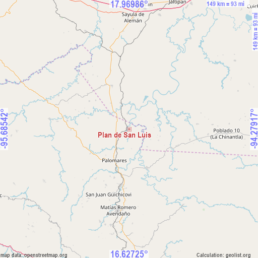
Plan de San Luis GPS coordinates[2]
17° 17' 59.208" North, 94° 58' 56.244" West
| Map corner | latitude | longitude |
|---|---|---|
| Upper-left | 17.96986°, | -95.68542° |
| Center: | 17.29978°, | -94.98229° |
| Lower-right: | 16.62725°, | -94.27917° |
| Map W x H: | 149.3×149.3 km | = 92.8×92.8mi |
| max Lat: | 32.7° ⇑85.3% North |
| Plan de San Luis: | 17.29978° |
| min Lat: | ⇓14.7% South 14.53588° |
| min Long | Plan de San Lui | max Long |
| -117.105° | -94.98229° | -86.73105° |
| W 84.7%⇐ | ⇒15.3% E |
Elevation
Elevation of Plan de San Luis is 49 m = 161 ft, and this is 1204.7 m = 3952 ft below average elevation for this country.
| Max E: |
3497 m = 11473 ft | 84.3% |
| Avg. | 1253.7 m = 4113 ft | |
| Plan de San Luis | 49 m = 161 ft | |
Min E: |
-1 m = -3 ft | 15.7% |
See also: Mexico elevation on elevation.city.
Geographical zone
Plan de San Luis is located in North Torrid zone (between Equator and Tropic of Cancer). Distance of this Northern Tropic circle is 682.4 km =424 mi to North.| Distance of | km | miles | from Plan de San Luis |
|---|---|---|---|
| North Pole | 8083.5 | 5022.9 | to North |
| Arctic Circle | 5477.6 | 3403.6 | to North |
| Tropic Cancer | 682.4 | 424 | to North |
| Equator | 1923.6 | 1195.3 | to South |


Nearby cities:
15 places around Plan de San Luis: (largest is in red/bold)
• Coapiloloyita
14.1 km =8.8 mi,  351°
351°
• Cuauhtémoc
24.3 km =15.1 mi,  154°
154°
• Donaji
10.8 km =6.7 mi,  223°
223°
• El Súchil
24.1 km =15 mi, 348°
• Jesús Carranza
15.8 km =9.8 mi,  342°
342°
• La Esmeralda
25.5 km =15.8 mi,  125°
125°
• La Nueva Raza
25.6 km =15.9 mi,  311°
311°
• Los Ángeles
22.1 km =13.7 mi,  298°
298°
• Modelo Dos Ríos
25.5 km =15.8 mi,  65°
65°
• Nuevo Progreso
19.3 km =12 mi,  201°
201°
• Palo Dulce
18.4 km =11.4 mi,  325°
325°
• Palomares
19.9 km =12.4 mi,  205°
205°
• Suchilapan del Río
9.6 km =6 mi,  356°
356°
• Tolosita
13.1 km =8.1 mi, 213°
• Veinticuatro
18.3 km =11.4 mi,  110°
110°
Sources, notices
• [Note1] Compared only with cities in Mexico existing in our database
• [Src1] Map data: © OpenStreetMap contributors (CC-BY-SA)
• [Src2] Other city data from geonames.org with taken over terms of usage.
• [Src3] Geographical zone / Annual Mean Temperature by Robert A. Rohde @ Wikipedia
