Cuauhtémoc geodata
Cuauhtémoc (Oaxaca) is a populated place; located in Mexico in America/Mexico_City (GMT-6) time zone. With population of 2,264 people, there are 3885 cities with bigger population in this country. Compared to other cities in Mexico, 87.7% of cities are located further ↑North; 84.9% of cities are located further ←West and 79.3% of cities have higher elevation than Cuauhtémoc. Note1


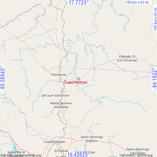
Cuauhtémoc GPS coordinates[2]
17° 6' 5.364" North, 94° 53' 7.152" West
| Map corner | latitude | longitude |
|---|---|---|
| Upper-left | 17.7723°, | -95.58845° |
| Center: | 17.10149°, | -94.88532° |
| Lower-right: | 16.42825°, | -94.1822° |
| Map W x H: | 149.4×149.4 km | = 92.8×92.8mi |
| max Lat: | 32.7° ⇑87.7% North |
| Cuauhtémoc: | 17.10149° |
| min Lat: | ⇓12.3% South 14.53588° |
| min Long | Cuauhtémoc | max Long |
| -117.105° | -94.88532° | -86.73105° |
| W 84.9%⇐ | ⇒15.1% E |
Elevation
Elevation of Cuauhtémoc is 106 m = 348 ft, and this is 1147.7 m = 3765 ft below average elevation for this country.
| Max E: |
3497 m = 11473 ft | 79.3% |
| Avg. | 1253.7 m = 4113 ft | |
| Cuauhtémoc | 106 m = 348 ft | |
Min E: |
-1 m = -3 ft | 20.7% |
See also: Mexico elevation on elevation.city.
Geographical zone
Cuauhtémoc is located in North Torrid zone (between Equator and Tropic of Cancer). Distance of this Northern Tropic circle is 704.4 km =437.7 mi to North.| Distance of | km | miles | from Cuauhtémoc |
|---|---|---|---|
| North Pole | 8105.6 | 5036.6 | to North |
| Arctic Circle | 5499.7 | 3417.4 | to North |
| Tropic Cancer | 704.4 | 437.7 | to North |
| Equator | 1901.5 | 1181.5 | to South |


Nearby cities:
15 places around Cuauhtémoc: (largest is in red/bold)
• Barreña
20 km =12.4 mi,  204°
204°
• Boca del Monte
14.6 km =9.1 mi,  252°
252°
• Donaji
22.8 km =14.2 mi,  308°
308°
• Estación Mogoñé
20 km =12.4 mi,  233°
233°
• La Esmeralda
12.6 km =7.8 mi,  55°
55°
• Mogoñé Viejo
18.3 km =11.4 mi, 234°
• Nuevo Progreso
18 km =11.2 mi,  283°
283°
• Palomares
19.3 km =12 mi, 282°
• Paso Real de Sarabia
17.4 km =10.8 mi,  259°
259°
• Piedra Blanca
18.5 km =11.5 mi, 227°
• Río Pachiñe
24.2 km =15 mi, 232°
• Santa Ana
21.9 km =13.6 mi, 256°
• Tolosita
20.8 km =12.9 mi,  302°
302°
• Veinticuatro
17 km =10.6 mi,  23°
23°
• Zarzal
18.9 km =11.7 mi,  239°
239°
Sources, notices
• [Note1] Compared only with cities in Mexico existing in our database
• [Src1] Map data: © OpenStreetMap contributors (CC-BY-SA)
• [Src2] Other city data from geonames.org with taken over terms of usage.
• [Src3] Geographical zone / Annual Mean Temperature by Robert A. Rohde @ Wikipedia
