Villa Margarita geodata
Villa Margarita (Hidalgo) is a populated place; located in Mexico in America/Mexico_City (GMT-6) time zone. With population of 727 people, there are 12009 cities with bigger population in this country. Compared to other cities in Mexico, 56.6% of cities are located further ↓South; 54.8% of cities are located further ←West and 88.3% of cities have lower elevation than Villa Margarita. Note1


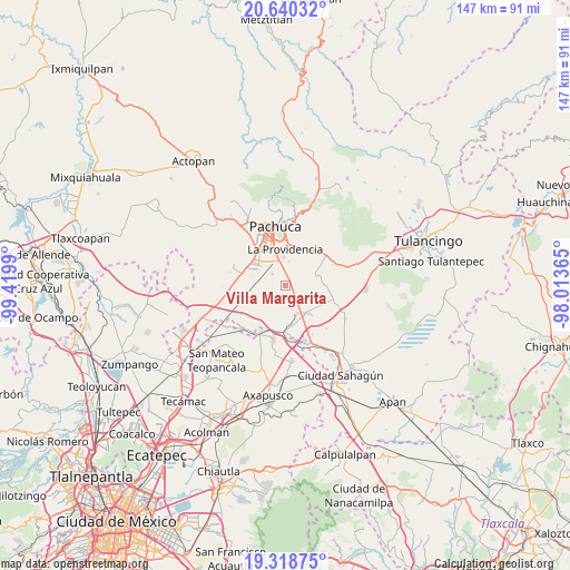
Villa Margarita GPS coordinates[2]
19° 58' 51.312" North, 98° 43' 0.372" West
| Map corner | latitude | longitude |
|---|---|---|
| Upper-left | 20.64032°, | -99.4199° |
| Center: | 19.98092°, | -98.71677° |
| Lower-right: | 19.31875°, | -98.01365° |
| Map W x H: | 146.9×146.9 km | = 91.3×91.3mi |
| max Lat: | 32.7° ⇑43.4% North |
| Villa Margarita: | 19.98092° |
| min Lat: | ⇓56.6% South 14.53588° |
| min Long | Villa Margarita | max Long |
| -117.105° | -98.71677° | -86.73105° |
| W 54.8%⇐ | ⇒45.2% E |
Elevation
Elevation of Villa Margarita is 2353 m = 7720 ft, and this is 1099.3 m = 3607 ft above average elevation for this country.
| Max E: |
3497 m = 11473 ft | 11.7% |
| Villa Margarita | 2353 m 7720 ft | |
| Avg. | 1253.7 m = 4113 ft | |
Min E: |
-1 m = -3 ft | 88.3% |
See also: Mexico elevation on elevation.city.
Geographical zone
Villa Margarita is located in North Torrid zone (between Equator and Tropic of Cancer). Distance of this Northern Tropic circle is 384.2 km =238.7 mi to North.| Distance of | km | miles | from Villa Margarita |
|---|---|---|---|
| North Pole | 7785.4 | 4837.6 | to North |
| Arctic Circle | 5179.5 | 3218.4 | to North |
| Tropic Cancer | 384.2 | 238.7 | to North |
| Equator | 2221.7 | 1380.5 | to South |


Nearby cities:
15 places around Villa Margarita: (largest is in red/bold)
• Colonia Guadalupe
6.9 km =4.3 mi,  227°
227°
• Jagüey de Téllez (Estación Téllez)
7.5 km =4.7 mi,  269°
269°
• La Trinidad
2.5 km =1.6 mi,  161°
161°
• Las Flores
9 km =5.6 mi,  327°
327°
• Los Tuzos
9.1 km =5.7 mi, 332°
• Rinconada de los Ángeles
5.1 km =3.2 mi,  6°
6°
• San Antonio Ostoyucan
7.9 km =4.9 mi,  136°
136°
• San José Palma Gorda
5.8 km =3.6 mi,  322°
322°
• San Miguel Nopalapa
3.9 km =2.4 mi, 6°
• San Pedro Tlaquilpan
5.5 km =3.4 mi,  223°
223°
• Santa Cruz
4.3 km =2.7 mi,  126°
126°
• Santa María la Calera
5.5 km =3.4 mi,  357°
357°
• Villas de San Marcos
9.1 km =5.7 mi,  305°
305°
• Xochihuacán
1 km =0.6 mi,  45°
45°
• Zempoala
9 km =5.6 mi, 143°
Sources, notices
• [Note1] Compared only with cities in Mexico existing in our database
• [Src1] Map data: © OpenStreetMap contributors (CC-BY-SA)
• [Src2] Other city data from geonames.org with taken over terms of usage.
• [Src3] Geographical zone / Annual Mean Temperature by Robert A. Rohde @ Wikipedia
