Ojo de Agua geodata
Ojo de Agua (State of Mexico) is a populated place; located in Mexico in America/Mexico_City (GMT-6) time zone. With population of 1,221 people, there are 7116 cities with bigger population in this country. Compared to other cities in Mexico, 56.4% of cities are located further ↓South; 56.5% of cities are located further →East and 88.7% of cities have lower elevation than Ojo de Agua. Note1


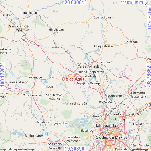
Ojo de Agua GPS coordinates[2]
19° 58' 16.212" North, 99° 28' 11.064" West
| Map corner | latitude | longitude |
|---|---|---|
| Upper-left | 20.63061°, | -100.17287° |
| Center: | 19.97117°, | -99.46974° |
| Lower-right: | 19.30896°, | -98.76662° |
| Map W x H: | 147×147 km | = 91.3×91.3mi |
| max Lat: | 32.7° ⇑43.6% North |
| Ojo de Agua: | 19.97117° |
| min Lat: | ⇓56.4% South 14.53588° |
| min Long | Ojo de Agua | max Long |
| -117.105° | -99.46974° | -86.73105° |
| W 43.5%⇐ | ⇒56.5% E |
Elevation
Elevation of Ojo de Agua is 2362 m = 7749 ft, and this is 1108.3 m = 3636 ft above average elevation for this country.
| Max E: |
3497 m = 11473 ft | 11.3% |
| Ojo de Agua | 2362 m 7749 ft | |
| Avg. | 1253.7 m = 4113 ft | |
Min E: |
-1 m = -3 ft | 88.7% |
See also: Mexico elevation on elevation.city.
Geographical zone
Ojo de Agua is located in North Torrid zone (between Equator and Tropic of Cancer). Distance of this Northern Tropic circle is 385.3 km =239.4 mi to North.| Distance of | km | miles | from Ojo de Agua |
|---|---|---|---|
| North Pole | 7786.5 | 4838.3 | to North |
| Arctic Circle | 5180.6 | 3219.1 | to North |
| Tropic Cancer | 385.3 | 239.4 | to North |
| Equator | 2220.6 | 1379.8 | to South |


Nearby cities:
15 places around Ojo de Agua: (largest is in red/bold)
• Cañada de Madero
8 km =5 mi,  94°
94°
• Coscomate del Progreso
6.6 km =4.1 mi,  231°
231°
• Denjhi
8.8 km =5.5 mi, 231°
• Dexcani Bajo
4.2 km =2.6 mi, 231°
• Ejido de Coscomate del Progreso
9.1 km =5.7 mi,  242°
242°
• El Huisache (Tercera Manzana de Dexcani Alto)
3.3 km =2.1 mi,  214°
214°
• Jilotepec de Molina Enríquez
6.9 km =4.3 mi,  252°
252°
• Las Huertas
9 km =5.6 mi,  270°
270°
• Ojo de Agua
2.7 km =1.7 mi,  77°
77°
• San Agustín Buenavista
8.3 km =5.2 mi,  345°
345°
• San Pablo Huantepec
2.6 km =1.6 mi,  298°
298°
• Santa Ana Azcapotzaltongo
9.1 km =5.7 mi,  109°
109°
• Soyaniquilpan
8 km =5 mi,  307°
307°
• Xhitey
6.2 km =3.9 mi,  280°
280°
• Xhixhata
8 km =5 mi, 269°
Sources, notices
• [Note1] Compared only with cities in Mexico existing in our database
• [Src1] Map data: © OpenStreetMap contributors (CC-BY-SA)
• [Src2] Other city data from geonames.org with taken over terms of usage.
• [Src3] Geographical zone / Annual Mean Temperature by Robert A. Rohde @ Wikipedia
