Ojo de Agua geodata
Ojo de Agua (Hidalgo) is a populated place; located in Mexico in America/Mexico_City (GMT-6) time zone. With population of 1,648 people, there are 5267 cities with bigger population in this country. Compared to other cities in Mexico, 56.5% of cities are located further ↓South; 56.1% of cities are located further →East and 88.3% of cities have lower elevation than Ojo de Agua. Note1


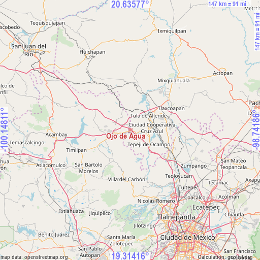
Ojo de Agua GPS coordinates[2]
19° 58' 34.86" North, 99° 26' 41.928" West
| Map corner | latitude | longitude |
|---|---|---|
| Upper-left | 20.63577°, | -100.14811° |
| Center: | 19.97635°, | -99.44498° |
| Lower-right: | 19.31416°, | -98.74186° |
| Map W x H: | 146.9×147 km | = 91.3×91.3mi |
| max Lat: | 32.7° ⇑43.5% North |
| Ojo de Agua: | 19.97635° |
| min Lat: | ⇓56.5% South 14.53588° |
| min Long | Ojo de Agua | max Long |
| -117.105° | -99.44498° | -86.73105° |
| W 43.9%⇐ | ⇒56.1% E |
Elevation
Elevation of Ojo de Agua is 2351 m = 7713 ft, and this is 1097.3 m = 3600 ft above average elevation for this country.
| Max E: |
3497 m = 11473 ft | 11.7% |
| Ojo de Agua | 2351 m 7713 ft | |
| Avg. | 1253.7 m = 4113 ft | |
Min E: |
-1 m = -3 ft | 88.3% |
See also: Mexico elevation on elevation.city.
Geographical zone
Ojo de Agua is located in North Torrid zone (between Equator and Tropic of Cancer). Distance of this Northern Tropic circle is 384.8 km =239.1 mi to North.| Distance of | km | miles | from Ojo de Agua |
|---|---|---|---|
| North Pole | 7785.9 | 4837.9 | to North |
| Arctic Circle | 5180 | 3218.7 | to North |
| Tropic Cancer | 384.8 | 239.1 | to North |
| Equator | 2221.2 | 1380.2 | to South |


Nearby cities:
15 places around Ojo de Agua: (largest is in red/bold)
• Cañada de Madero
5.5 km =3.4 mi,  102°
102°
• Coscomate del Progreso
9 km =5.6 mi,  238°
238°
• Dexcani Bajo
6.7 km =4.2 mi, 241°
• El Huisache (Tercera Manzana de Dexcani Alto)
5.5 km =3.4 mi,  233°
233°
• Jilotepec de Molina Enríquez
9.6 km =6 mi,  253°
253°
• Ojo de Agua
2.7 km =1.7 mi,  257°
257°
• San Agustín Buenavista
8.8 km =5.5 mi,  327°
327°
• San Ildefonso
7.9 km =4.9 mi,  73°
73°
• San Lucas Teacalco
8.8 km =5.5 mi,  86°
86°
• San Pablo Huantepec
4.9 km =3 mi,  277°
277°
• Santa Ana Azcapotzaltongo
7 km =4.3 mi,  121°
121°
• Santa María Magdalena
7.4 km =4.6 mi, 92°
• Santiago Tlautla
8.1 km =5 mi, 101°
• Soyaniquilpan
9.9 km =6.2 mi,  295°
295°
• Xhitey
8.7 km =5.4 mi,  273°
273°
Sources, notices
• [Note1] Compared only with cities in Mexico existing in our database
• [Src1] Map data: © OpenStreetMap contributors (CC-BY-SA)
• [Src2] Other city data from geonames.org with taken over terms of usage.
• [Src3] Geographical zone / Annual Mean Temperature by Robert A. Rohde @ Wikipedia
