San Agustín Buenavista geodata
San Agustín Buenavista (State of Mexico) is a populated place; located in Mexico in America/Mexico_City (GMT-6) time zone. With population of 1,271 people, there are 6818 cities with bigger population in this country. Compared to other cities in Mexico, 57.9% of cities are located further ↓South; 56.8% of cities are located further →East and 87.2% of cities have lower elevation than San Agustín Buenavista. Note1


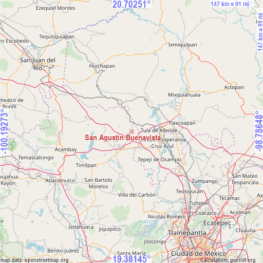
San Agustín Buenavista GPS coordinates[2]
20° 2' 36.132" North, 99° 29' 22.56" West
| Map corner | latitude | longitude |
|---|---|---|
| Upper-left | 20.70251°, | -100.19273° |
| Center: | 20.04337°, | -99.4896° |
| Lower-right: | 19.38145°, | -98.78648° |
| Map W x H: | 146.9×146.9 km | = 91.3×91.3mi |
| max Lat: | 32.7° ⇑42.1% North |
| San Agustín Buenavista: | 20.04337° |
| min Lat: | ⇓57.9% South 14.53588° |
| min Long | San Agustín Bu | max Long |
| -117.105° | -99.4896° | -86.73105° |
| W 43.2%⇐ | ⇒56.8% E |
Elevation
Elevation of San Agustín Buenavista is 2314 m = 7592 ft, and this is 1060.3 m = 3479 ft above average elevation for this country.
| Max E: |
3497 m = 11473 ft | 12.8% |
| San Agustín Buenavista | 2314 m 7592 ft | |
| Avg. | 1253.7 m = 4113 ft | |
Min E: |
-1 m = -3 ft | 87.2% |
See also: Mexico elevation on elevation.city.
Geographical zone
San Agustín Buenavista is located in North Torrid zone (between Equator and Tropic of Cancer). Distance of this Northern Tropic circle is 377.3 km =234.4 mi to North.| Distance of | km | miles | from San Agustín Buenavista |
|---|---|---|---|
| North Pole | 7778.4 | 4833.3 | to North |
| Arctic Circle | 5172.6 | 3214.1 | to North |
| Tropic Cancer | 377.3 | 234.4 | to North |
| Equator | 2228.6 | 1384.8 | to South |


Nearby cities:
15 places around San Agustín Buenavista: (largest is in red/bold)
• Dexcani Bajo
10.7 km =6.6 mi,  186°
186°
• El Huisache (Tercera Manzana de Dexcani Alto)
10.8 km =6.7 mi,  178°
178°
• La Comunidad
9.4 km =5.8 mi,  254°
254°
• Las Huertas
10.5 km =6.5 mi,  221°
221°
• Ojo de Agua
8.3 km =5.2 mi,  165°
165°
• Ojo de Agua
8.8 km =5.5 mi,  147°
147°
• San José Deguedó
9.1 km =5.7 mi,  301°
301°
• San Juan Daxthi
7.2 km =4.5 mi,  328°
328°
• San Miguel de La Victoria
10.7 km =6.6 mi,  277°
277°
• San Pablo Huantepec
6.8 km =4.2 mi, 181°
• Santa Maria Macua
10.4 km =6.5 mi,  8°
8°
• Santiago Oxthoc
9.9 km =6.2 mi,  324°
324°
• Soyaniquilpan
5.3 km =3.3 mi,  233°
233°
• Xhitey
7.9 km =4.9 mi,  210°
210°
• Xhixhata
10 km =6.2 mi, 216°
Sources, notices
• [Note1] Compared only with cities in Mexico existing in our database
• [Src1] Map data: © OpenStreetMap contributors (CC-BY-SA)
• [Src2] Other city data from geonames.org with taken over terms of usage.
• [Src3] Geographical zone / Annual Mean Temperature by Robert A. Rohde @ Wikipedia
