Nexnopala geodata
Nexnopala (Tlaxcala) is a populated place; located in Mexico in America/Mexico_City (GMT-6) time zone. With population of 695 people, there are 12521 cities with bigger population in this country. Compared to other cities in Mexico, 56.3% of cities are located further ↑North; 66.3% of cities are located further ←West and 92.3% of cities have lower elevation than Nexnopala. Note1


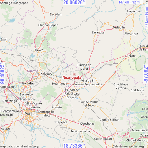
Nexnopala GPS coordinates[2]
19° 23' 54.276" North, 97° 47' 6.432" West
| Map corner | latitude | longitude |
|---|---|---|
| Upper-left | 20.06026°, | -98.48825° |
| Center: | 19.39841°, | -97.78512° |
| Lower-right: | 18.73386°, | -97.082° |
| Map W x H: | 147.5×147.5 km | = 91.7×91.7mi |
| max Lat: | 32.7° ⇑56.3% North |
| Nexnopala: | 19.39841° |
| min Lat: | ⇓43.7% South 14.53588° |
| min Long | Nexnopala | max Long |
| -117.105° | -97.78512° | -86.73105° |
| W 66.3%⇐ | ⇒33.7% E |
Elevation
Elevation of Nexnopala is 2495 m = 8186 ft, and this is 1241.3 m = 4073 ft above average elevation for this country.
| Max E: |
3497 m = 11473 ft | 7.7% |
| Nexnopala | 2495 m 8186 ft | |
| Avg. | 1253.7 m = 4113 ft | |
Min E: |
-1 m = -3 ft | 92.3% |
See also: Mexico elevation on elevation.city.
Geographical zone
Nexnopala is located in North Torrid zone (between Equator and Tropic of Cancer). Distance of this Northern Tropic circle is 449 km =279 mi to North.| Distance of | km | miles | from Nexnopala |
|---|---|---|---|
| North Pole | 7850.2 | 4877.9 | to North |
| Arctic Circle | 5244.3 | 3258.7 | to North |
| Tropic Cancer | 449 | 279 | to North |
| Equator | 2156.9 | 1340.2 | to South |


Nearby cities:
15 places around Nexnopala: (largest is in red/bold)
• Altzayanca
3.8 km =2.4 mi,  343°
343°
• Atlzayanca
3.8 km =2.4 mi, 343°
• Ayehualaco (San Martín)
9.3 km =5.8 mi,  61°
61°
• Colonia Ignacio Allende
4.6 km =2.9 mi,  178°
178°
• Colonia José María Morelos
10 km =6.2 mi,  114°
114°
• Colonia el Valle
9.8 km =6.1 mi,  243°
243°
• Concepción Hidalgo
3.6 km =2.2 mi,  269°
269°
• Felipe Carrillo Puerto
7.4 km =4.6 mi, 270°
• Guerrero
10.9 km =6.8 mi,  69°
69°
• Ranchería de Pocitos
2.7 km =1.7 mi,  100°
100°
• San Carlos
10.9 km =6.8 mi, 65°
• San José Xicohténcatl
6.8 km =4.2 mi,  224°
224°
• Santa Cruz Pocitos
3.3 km =2.1 mi,  130°
130°
• Santa María las Cuevas
5 km =3.1 mi, 105°
• Xaltitla
2.9 km =1.8 mi,  23°
23°
Sources, notices
• [Note1] Compared only with cities in Mexico existing in our database
• [Src1] Map data: © OpenStreetMap contributors (CC-BY-SA)
• [Src2] Other city data from geonames.org with taken over terms of usage.
• [Src3] Geographical zone / Annual Mean Temperature by Robert A. Rohde @ Wikipedia
