San José Xicohténcatl geodata
San José Xicohténcatl (Tlaxcala) is a populated place; located in Mexico in America/Mexico_City (GMT-6) time zone. With population of 5,761 people, there are 1614 cities with bigger population in this country. Compared to other cities in Mexico, 57.5% of cities are located further ↑North; 65.7% of cities are located further ←West and 91.3% of cities have lower elevation than San José Xicohténcatl. Note1


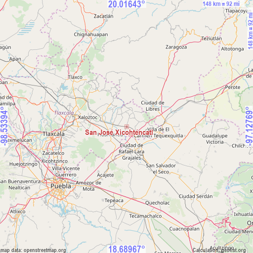
San José Xicohténcatl GPS coordinates[2]
19° 21' 15.84" North, 97° 49' 50.916" West
| Map corner | latitude | longitude |
|---|---|---|
| Upper-left | 20.01643°, | -98.53394° |
| Center: | 19.3544°, | -97.83081° |
| Lower-right: | 18.68967°, | -97.12769° |
| Map W x H: | 147.5×147.5 km | = 91.7×91.7mi |
| max Lat: | 32.7° ⇑57.5% North |
| San José Xicohténcatl: | 19.3544° |
| min Lat: | ⇓42.5% South 14.53588° |
| min Long | San José Xicoh | max Long |
| -117.105° | -97.83081° | -86.73105° |
| W 65.7%⇐ | ⇒34.3% E |
Elevation
Elevation of San José Xicohténcatl is 2455 m = 8054 ft, and this is 1201.3 m = 3941 ft above average elevation for this country.
| Max E: |
3497 m = 11473 ft | 8.7% |
| San José Xicohténcatl | 2455 m 8054 ft | |
| Avg. | 1253.7 m = 4113 ft | |
Min E: |
-1 m = -3 ft | 91.3% |
See also: Mexico elevation on elevation.city.
Geographical zone
San José Xicohténcatl is located in North Torrid zone (between Equator and Tropic of Cancer). Distance of this Northern Tropic circle is 453.9 km =282 mi to North.| Distance of | km | miles | from San José Xicohténcatl |
|---|---|---|---|
| North Pole | 7855.1 | 4880.9 | to North |
| Arctic Circle | 5249.2 | 3261.7 | to North |
| Tropic Cancer | 453.9 | 282 | to North |
| Equator | 2152 | 1337.2 | to South |


Nearby cities:
15 places around San José Xicohténcatl: (largest is in red/bold)
• Altzayanca
9.3 km =5.8 mi,  23°
23°
• Atlzayanca
9.3 km =5.8 mi, 23°
• Benito Juárez
8.5 km =5.3 mi,  284°
284°
• Colonia Ignacio Allende
4.9 km =3 mi,  87°
87°
• Colonia el Valle
4 km =2.5 mi, 276°
• Concepción Hidalgo
5 km =3.1 mi,  13°
13°
• Cuapiaxtla
9.2 km =5.7 mi,  135°
135°
• Felipe Carrillo Puerto
5.6 km =3.5 mi,  332°
332°
• Máximo Serdán
10.2 km =6.3 mi,  178°
178°
• Nexnopala
6.8 km =4.2 mi,  44°
44°
• Plan de Ayala
10.9 km =6.8 mi,  117°
117°
• Ranchería de Pocitos
8.7 km =5.4 mi,  59°
59°
• Santa Cruz Pocitos
7.8 km =4.8 mi,  69°
69°
• Santa María las Cuevas
10.2 km =6.3 mi, 69°
• Xaltitla
9.6 km =6 mi, 38°
Sources, notices
• [Note1] Compared only with cities in Mexico existing in our database
• [Src1] Map data: © OpenStreetMap contributors (CC-BY-SA)
• [Src2] Other city data from geonames.org with taken over terms of usage.
• [Src3] Geographical zone / Annual Mean Temperature by Robert A. Rohde @ Wikipedia
