San Miguel Xochitecatitla geodata
San Miguel Xochitecatitla (Tlaxcala) is a populated place; located in Mexico in America/Mexico_City (GMT-6) time zone. With population of 2,124 people, there are 4122 cities with bigger population in this country. Compared to other cities in Mexico, 60.2% of cities are located further ↑North; 59.2% of cities are located further ←West and 83.1% of cities have lower elevation than San Miguel Xochitecatitla. Note1
Current local time in San Miguel Xochitecatitla:
06:47 AM, WednesdayDifference from your time zone: hours


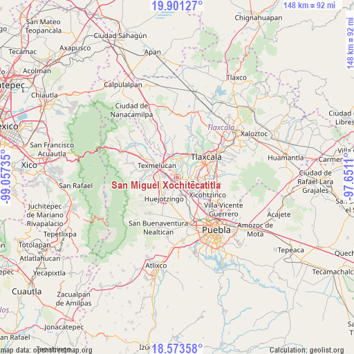
San Miguel Xochitecatitla GPS coordinates[2]
19° 14' 19.572" North, 98° 21' 15.192" West
| Map corner | latitude | longitude |
|---|---|---|
| Upper-left | 19.90127°, | -99.05735° |
| Center: | 19.23877°, | -98.35422° |
| Lower-right: | 18.57358°, | -97.6511° |
| Map W x H: | 147.6×147.6 km | = 91.7×91.7mi |
| max Lat: | 32.7° ⇑60.2% North |
| San Miguel Xochitecatitla: | 19.23877° |
| min Lat: | ⇓39.8% South 14.53588° |
| min Long | San Miguel Xoch | max Long |
| -117.105° | -98.35422° | -86.73105° |
| W 59.2%⇐ | ⇒40.8% E |
Elevation
Elevation of San Miguel Xochitecatitla is 2219 m = 7280 ft, and this is 965.3 m = 3167 ft above average elevation for this country.
| Max E: |
3497 m = 11473 ft | 16.9% |
| San Miguel Xochitecatitla | 2219 m 7280 ft | |
| Avg. | 1253.7 m = 4113 ft | |
Min E: |
-1 m = -3 ft | 83.1% |
See also: Mexico elevation on elevation.city.
Geographical zone
San Miguel Xochitecatitla is located in North Torrid zone (between Equator and Tropic of Cancer). Distance of this Northern Tropic circle is 466.8 km =290.1 mi to North.| Distance of | km | miles | from San Miguel Xochitecatitla |
|---|---|---|---|
| North Pole | 7867.9 | 4888.9 | to North |
| Arctic Circle | 5262 | 3269.7 | to North |
| Tropic Cancer | 466.8 | 290.1 | to North |
| Equator | 2139.2 | 1329.2 | to South |


Nearby cities:
15 places around San Miguel Xochitecatitla: (largest is in red/bold)
• Guadalupe Victoria
2.2 km =1.4 mi,  108°
108°
• Guadalupe Victoria
5.6 km =3.5 mi,  324°
324°
• Jesús Tepactepec
4.3 km =2.7 mi,  104°
104°
• Moyotzingo
5.4 km =3.4 mi,  281°
281°
• Natívitas
4.2 km =2.6 mi, 98°
• San Francisco Tenexyecac
6 km =3.7 mi,  43°
43°
• San José Atoyatenco
1.3 km =0.8 mi,  355°
355°
• San Miguel del Milagro
2.2 km =1.4 mi,  82°
82°
• San Rafael Tenanyecac
2.1 km =1.3 mi,  299°
299°
• Santa Ana Xalmimilulco
4.1 km =2.5 mi,  225°
225°
• Santa Apolonia Teacalco
4.5 km =2.8 mi,  86°
86°
• Santa Inés Tecuexcomac
6.2 km =3.9 mi,  6°
6°
• Santiago Michac
2.6 km =1.6 mi,  143°
143°
• Santo Tomás la Concordia
3.8 km =2.4 mi, 106°
• Tepetitla
3.8 km =2.4 mi, 321°
Sources, notices
• [Note1] Compared only with cities in Mexico existing in our database
• [Src1] Map data: © OpenStreetMap contributors (CC-BY-SA)
• [Src2] Other city data from geonames.org with taken over terms of usage.
• [Src3] Geographical zone / Annual Mean Temperature by Robert A. Rohde @ Wikipedia
