San Rafael Tenanyecac geodata
San Rafael Tenanyecac (Tlaxcala) is a populated place; located in Mexico in America/Mexico_City (GMT-6) time zone. With population of 2,699 people, there are 3280 cities with bigger population in this country. Compared to other cities in Mexico, 59.9% of cities are located further ↑North; 59% of cities are located further ←West and 83.2% of cities have lower elevation than San Rafael Tenanyecac. Note1


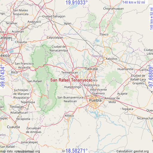
San Rafael Tenanyecac GPS coordinates[2]
19° 14' 52.296" North, 98° 22' 16.356" West
| Map corner | latitude | longitude |
|---|---|---|
| Upper-left | 19.91033°, | -99.07434° |
| Center: | 19.24786°, | -98.37121° |
| Lower-right: | 18.58271°, | -97.66809° |
| Map W x H: | 147.6×147.6 km | = 91.7×91.7mi |
| max Lat: | 32.7° ⇑59.9% North |
| San Rafael Tenanyecac: | 19.24786° |
| min Lat: | ⇓40.1% South 14.53588° |
| min Long | San Rafael Tena | max Long |
| -117.105° | -98.37121° | -86.73105° |
| W 59%⇐ | ⇒41% E |
Elevation
Elevation of San Rafael Tenanyecac is 2223 m = 7293 ft, and this is 969.3 m = 3180 ft above average elevation for this country.
| Max E: |
3497 m = 11473 ft | 16.8% |
| San Rafael Tenanyecac | 2223 m 7293 ft | |
| Avg. | 1253.7 m = 4113 ft | |
Min E: |
-1 m = -3 ft | 83.2% |
See also: Mexico elevation on elevation.city.
Geographical zone
San Rafael Tenanyecac is located in North Torrid zone (between Equator and Tropic of Cancer). Distance of this Northern Tropic circle is 465.8 km =289.4 mi to North.| Distance of | km | miles | from San Rafael Tenanyecac |
|---|---|---|---|
| North Pole | 7866.9 | 4888.3 | to North |
| Arctic Circle | 5261 | 3269 | to North |
| Tropic Cancer | 465.8 | 289.4 | to North |
| Equator | 2140.2 | 1329.9 | to South |


Nearby cities:
15 places around San Rafael Tenanyecac: (largest is in red/bold)
• Guadalupe Victoria
3.9 km =2.4 mi,  337°
337°
• Guadalupe Victoria
4.2 km =2.6 mi,  114°
114°
• Moyotzingo
3.5 km =2.2 mi,  270°
270°
• Natívitas
6.1 km =3.8 mi, 105°
• San José Atoyatenco
1.7 km =1.1 mi,  78°
78°
• San Mateo Ayecac
4.2 km =2.6 mi,  324°
324°
• San Miguel Xochitecatitla
2.1 km =1.3 mi,  119°
119°
• San Miguel del Milagro
4 km =2.5 mi,  100°
100°
• Santa Ana Xalmimilulco
4.1 km =2.5 mi,  196°
196°
• Santa Inés Tecuexcomac
5.7 km =3.5 mi,  26°
26°
• Santiago Michac
4.6 km =2.9 mi,  132°
132°
• Santo Tomás la Concordia
5.8 km =3.6 mi, 110°
• Tepetitla
2 km =1.2 mi, 344°
• Tianguismanalco
5.5 km =3.4 mi,  262°
262°
• Villa Alta
5.9 km =3.7 mi,  327°
327°
Sources, notices
• [Note1] Compared only with cities in Mexico existing in our database
• [Src1] Map data: © OpenStreetMap contributors (CC-BY-SA)
• [Src2] Other city data from geonames.org with taken over terms of usage.
• [Src3] Geographical zone / Annual Mean Temperature by Robert A. Rohde @ Wikipedia
