Juan Aldama geodata
Juan Aldama (Chiapas) is a populated place; located in Mexico in America/Mexico_City (GMT-6) time zone. With population of 3,501 people, there are 2609 cities with bigger population in this country. Compared to other cities in Mexico, 82.1% of cities are located further ↑North; 88.4% of cities are located further ←West and 91.2% of cities have higher elevation than Juan Aldama. Note1


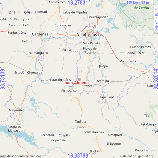
Juan Aldama GPS coordinates[2]
17° 36' 33.804" North, 93° 1' 41.736" West
| Map corner | latitude | longitude |
|---|---|---|
| Upper-left | 18.27831°, | -93.73139° |
| Center: | 17.60939°, | -93.02826° |
| Lower-right: | 16.93798°, | -92.32514° |
| Map W x H: | 149×149 km | = 92.6×92.6mi |
| max Lat: | 32.7° ⇑82.1% North |
| Juan Aldama: | 17.60939° |
| min Lat: | ⇓17.9% South 14.53588° |
| min Long | Juan Aldama | max Long |
| -117.105° | -93.02826° | -86.73105° |
| W 88.4%⇐ | ⇒11.6% E |
Elevation
Elevation of Juan Aldama is 21 m = 69 ft, and this is 1232.7 m = 4044 ft below average elevation for this country.
| Max E: |
3497 m = 11473 ft | 91.2% |
| Avg. | 1253.7 m = 4113 ft | |
| Juan Aldama | 21 m = 69 ft | |
Min E: |
-1 m = -3 ft | 8.8% |
See also: Mexico elevation on elevation.city.
Geographical zone
Juan Aldama is located in North Torrid zone (between Equator and Tropic of Cancer). Distance of this Northern Tropic circle is 647.9 km =402.6 mi to North.| Distance of | km | miles | from Juan Aldama |
|---|---|---|---|
| North Pole | 8049.1 | 5001.5 | to North |
| Arctic Circle | 5443.2 | 3382.2 | to North |
| Tropic Cancer | 647.9 | 402.6 | to North |
| Equator | 1958 | 1216.6 | to South |


Nearby cities:
15 places around Juan Aldama: (largest is in red/bold)
• Andrés Quintana Roo
11.1 km =6.9 mi,  9°
9°
• Chapultepec
7.7 km =4.8 mi,  130°
130°
• Colonia Municipal
5.5 km =3.4 mi,  110°
110°
• Colorado (Benito Juárez)
3.9 km =2.4 mi, 6°
• Doctor Belisario Domínguez
12.9 km =8 mi,  267°
267°
• Eureka y Belén
11.9 km =7.4 mi,  117°
117°
• Hermenegildo Galeana
9.5 km =5.9 mi,  17°
17°
• Ignacio Allende 2da. Sección
7.6 km =4.7 mi,  146°
146°
• Ixtapangajoya
12.7 km =7.9 mi,  167°
167°
• José María Morelos y Pavón (Las Delicias)
10.4 km =6.5 mi,  72°
72°
• Manuel Buelta 2da. Sección
7.6 km =4.7 mi, 116°
• Mariano Abasolo
9.4 km =5.8 mi,  137°
137°
• Mariano Matamoros Segunda Sección
11.4 km =7.1 mi,  231°
231°
• Nuevo Nicapa
5.5 km =3.4 mi,  300°
300°
• Teapa
10.4 km =6.5 mi, 129°
Sources, notices
• [Note1] Compared only with cities in Mexico existing in our database
• [Src1] Map data: © OpenStreetMap contributors (CC-BY-SA)
• [Src2] Other city data from geonames.org with taken over terms of usage.
• [Src3] Geographical zone / Annual Mean Temperature by Robert A. Rohde @ Wikipedia
