Colonia Municipal geodata
Colonia Municipal (Tabasco) is a populated place; located in Mexico in America/Mexico_City (GMT-6) time zone. With population of 518 people, there are 16254 cities with bigger population in this country. Compared to other cities in Mexico, 82.3% of cities are located further ↑North; 88.7% of cities are located further ←West and 90.4% of cities have higher elevation than Colonia Municipal. Note1


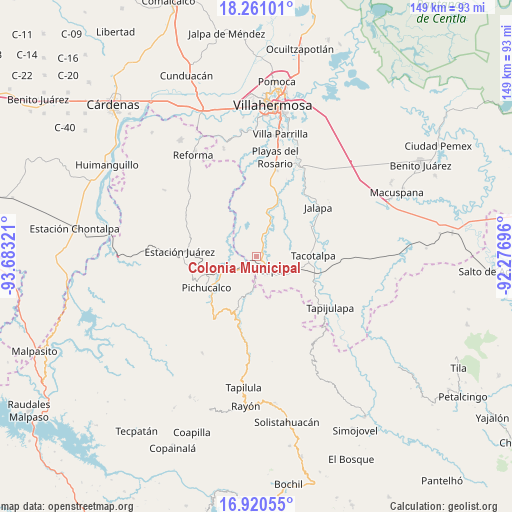
Colonia Municipal GPS coordinates[2]
17° 35' 31.272" North, 92° 58' 48.288" West
| Map corner | latitude | longitude |
|---|---|---|
| Upper-left | 18.26101°, | -93.68321° |
| Center: | 17.59202°, | -92.98008° |
| Lower-right: | 16.92055°, | -92.27696° |
| Map W x H: | 149×149 km | = 92.6×92.6mi |
| max Lat: | 32.7° ⇑82.3% North |
| Colonia Municipal: | 17.59202° |
| min Lat: | ⇓17.7% South 14.53588° |
| min Long | Colonia Municip | max Long |
| -117.105° | -92.98008° | -86.73105° |
| W 88.7%⇐ | ⇒11.3% E |
Elevation
Elevation of Colonia Municipal is 23 m = 75 ft, and this is 1230.7 m = 4038 ft below average elevation for this country.
| Max E: |
3497 m = 11473 ft | 90.4% |
| Avg. | 1253.7 m = 4113 ft | |
| Colonia Municipal | 23 m = 75 ft | |
Min E: |
-1 m = -3 ft | 9.6% |
See also: Mexico elevation on elevation.city.
Geographical zone
Colonia Municipal is located in North Torrid zone (between Equator and Tropic of Cancer). Distance of this Northern Tropic circle is 649.9 km =403.8 mi to North.| Distance of | km | miles | from Colonia Municipal |
|---|---|---|---|
| North Pole | 8051 | 5002.7 | to North |
| Arctic Circle | 5445.1 | 3383.4 | to North |
| Tropic Cancer | 649.9 | 403.8 | to North |
| Equator | 1956 | 1215.4 | to South |


Nearby cities:
15 places around Colonia Municipal: (largest is in red/bold)
• Andrés Quintana Roo
13.3 km =8.3 mi,  345°
345°
• Chapultepec
3.1 km =1.9 mi,  165°
165°
• Colorado (Benito Juárez)
7.5 km =4.7 mi,  321°
321°
• Eureka y Belén
6.5 km =4 mi,  123°
123°
• Hermenegildo Galeana
11.3 km =7 mi, 348°
• Ignacio Allende 2da. Sección
4.5 km =2.8 mi,  191°
191°
• Ixtapangajoya
10.6 km =6.6 mi, 192°
• José María Morelos y Pavón (Las Delicias)
7 km =4.3 mi,  44°
44°
• Juan Aldama
5.5 km =3.4 mi,  290°
290°
• Manuel Buelta 2da. Sección
2.3 km =1.4 mi,  131°
131°
• Manuel Buelta y Rayón
12.8 km =8 mi,  12°
12°
• Mariano Abasolo
5.2 km =3.2 mi, 166°
• Nuevo Nicapa
10.9 km =6.8 mi,  295°
295°
• Teapa
5.6 km =3.5 mi,  147°
147°
• Vicente Guerrero
10.7 km =6.6 mi, 145°
Sources, notices
• [Note1] Compared only with cities in Mexico existing in our database
• [Src1] Map data: © OpenStreetMap contributors (CC-BY-SA)
• [Src2] Other city data from geonames.org with taken over terms of usage.
• [Src3] Geographical zone / Annual Mean Temperature by Robert A. Rohde @ Wikipedia
