Chapultepec geodata
Chapultepec (Tabasco) is a populated place; located in Mexico in America/Mexico_City (GMT-6) time zone. With population of 744 people, there are 11771 cities with bigger population in this country. Compared to other cities in Mexico, 82.5% of cities are located further ↑North; 88.7% of cities are located further ←West and 85.9% of cities have higher elevation than Chapultepec. Note1


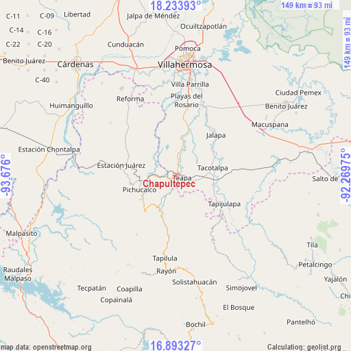
Chapultepec GPS coordinates[2]
17° 33' 53.424" North, 92° 58' 22.332" West
| Map corner | latitude | longitude |
|---|---|---|
| Upper-left | 18.23393°, | -93.676° |
| Center: | 17.56484°, | -92.97287° |
| Lower-right: | 16.89327°, | -92.26975° |
| Map W x H: | 149.1×149.1 km | = 92.6×92.6mi |
| max Lat: | 32.7° ⇑82.5% North |
| Chapultepec: | 17.56484° |
| min Lat: | ⇓17.5% South 14.53588° |
| min Long | Chapultepec | max Long |
| -117.105° | -92.97287° | -86.73105° |
| W 88.7%⇐ | ⇒11.3% E |
Elevation
Elevation of Chapultepec is 39 m = 128 ft, and this is 1214.7 m = 3985 ft below average elevation for this country.
| Max E: |
3497 m = 11473 ft | 85.9% |
| Avg. | 1253.7 m = 4113 ft | |
| Chapultepec | 39 m = 128 ft | |
Min E: |
-1 m = -3 ft | 14.1% |
See also: Mexico elevation on elevation.city.
Geographical zone
Chapultepec is located in North Torrid zone (between Equator and Tropic of Cancer). Distance of this Northern Tropic circle is 652.9 km =405.7 mi to North.| Distance of | km | miles | from Chapultepec |
|---|---|---|---|
| North Pole | 8054 | 5004.5 | to North |
| Arctic Circle | 5448.1 | 3385.3 | to North |
| Tropic Cancer | 652.9 | 405.7 | to North |
| Equator | 1953 | 1213.5 | to South |


Nearby cities:
15 places around Chapultepec: (largest is in red/bold)
• Ceiba 2da. Sección (San Luis)
13.4 km =8.3 mi,  78°
78°
• Colonia Municipal
3.1 km =1.9 mi,  345°
345°
• Colorado (Benito Juárez)
10.4 km =6.5 mi,  328°
328°
• Eureka y Belén
4.7 km =2.9 mi,  97°
97°
• Hermenegildo Galeana
14.4 km =8.9 mi, 347°
• Ignacio Allende 2da. Sección
2.1 km =1.3 mi,  229°
229°
• Ixtapangajoya
8 km =5 mi,  202°
202°
• José María Morelos y Pavón (Las Delicias)
9 km =5.6 mi,  27°
27°
• Juan Aldama
7.7 km =4.8 mi,  310°
310°
• La Gloria
13.8 km =8.6 mi,  171°
171°
• Manuel Buelta 2da. Sección
1.8 km =1.1 mi, 31°
• Mariano Abasolo
2 km =1.2 mi, 168°
• Nuevo Nicapa
13.1 km =8.1 mi, 306°
• Teapa
2.8 km =1.7 mi,  127°
127°
• Vicente Guerrero
7.8 km =4.8 mi,  136°
136°
Sources, notices
• [Note1] Compared only with cities in Mexico existing in our database
• [Src1] Map data: © OpenStreetMap contributors (CC-BY-SA)
• [Src2] Other city data from geonames.org with taken over terms of usage.
• [Src3] Geographical zone / Annual Mean Temperature by Robert A. Rohde @ Wikipedia
