Calatraba geodata
Calatraba (Chiapas) is a populated place; located in Mexico in America/Mexico_City (GMT-6) time zone. With population of 522 people, there are 16162 cities with bigger population in this country. Compared to other cities in Mexico, 80.7% of cities are located further ↑North; 95.8% of cities are located further ←West and 97% of cities have higher elevation than Calatraba. Note1


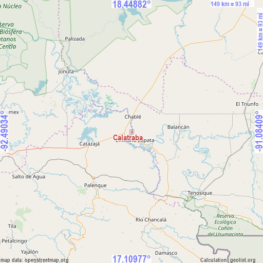
Calatraba GPS coordinates[2]
17° 46' 49.98" North, 91° 47' 13.956" West
| Map corner | latitude | longitude |
|---|---|---|
| Upper-left | 18.44882°, | -92.49034° |
| Center: | 17.78055°, | -91.78721° |
| Lower-right: | 17.10977°, | -91.08409° |
| Map W x H: | 148.9×148.9 km | = 92.5×92.5mi |
| max Lat: | 32.7° ⇑80.7% North |
| Calatraba: | 17.78055° |
| min Lat: | ⇓19.3% South 14.53588° |
| min Long | Calatraba | max Long |
| -117.105° | -91.78721° | -86.73105° |
| W 95.8%⇐ | ⇒4.2% E |
Elevation
Elevation of Calatraba is 10 m = 33 ft, and this is 1243.7 m = 4080 ft below average elevation for this country.
| Max E: |
3497 m = 11473 ft | 97% |
| Avg. | 1253.7 m = 4113 ft | |
| Calatraba | 10 m = 33 ft | |
Min E: |
-1 m = -3 ft | 3% |
See also: Mexico elevation on elevation.city.
Geographical zone
Calatraba is located in North Torrid zone (between Equator and Tropic of Cancer). Distance of this Northern Tropic circle is 628.9 km =390.8 mi to North.| Distance of | km | miles | from Calatraba |
|---|---|---|---|
| North Pole | 8030.1 | 4989.7 | to North |
| Arctic Circle | 5424.2 | 3370.4 | to North |
| Tropic Cancer | 628.9 | 390.8 | to North |
| Equator | 1977 | 1228.5 | to South |


Nearby cities:
15 places around Calatraba: (largest is in red/bold)
• Balancán
26.7 km =16.6 mi,  83°
83°
• Benito Juárez Centro
22 km =13.7 mi,  154°
154°
• Boca de San Jerónimo
19.2 km =11.9 mi,  315°
315°
• Catazajá
24.7 km =15.3 mi,  255°
255°
• Chablé
8.7 km =5.4 mi,  4°
4°
• Chacama
22.6 km =14 mi,  126°
126°
• El Paraíso
27.1 km =16.8 mi,  272°
272°
• Emiliano Zapata
5 km =3.1 mi, 153°
• Ignacio Zaragoza
21.6 km =13.4 mi, 271°
• José María Morelos y Pavón Centro
11.3 km =7 mi,  193°
193°
• La Guayaba (Alto Amatitán)
13.7 km =8.5 mi,  346°
346°
• La Libertad
12.5 km =7.8 mi, 145°
• Leona Vicario
27.8 km =17.3 mi,  110°
110°
• Playa Larga
17.3 km =10.7 mi, 353°
• Vicente Guerrero
16.1 km =10 mi,  95°
95°
Sources, notices
• [Note1] Compared only with cities in Mexico existing in our database
• [Src1] Map data: © OpenStreetMap contributors (CC-BY-SA)
• [Src2] Other city data from geonames.org with taken over terms of usage.
• [Src3] Geographical zone / Annual Mean Temperature by Robert A. Rohde @ Wikipedia
