La Guayaba (Alto Amatitán) geodata
La Guayaba (Alto Amatitán) (Tabasco) is a populated place; located in Mexico in America/Mexico_City (GMT-6) time zone. With population of 727 people, there are 12009 cities with bigger population in this country. Compared to other cities in Mexico, 79.7% of cities are located further ↑North; 95.8% of cities are located further ←West and 99.1% of cities have higher elevation than La Guayaba (Alto Amatitán). Note1
Current local time in La Guayaba (Alto Amatitán):
01:41 PM, MondayDifference from your time zone: hours


La Guayaba (Alto Amatitán) GPS coordinates[2]
17° 54' 1.764" North, 91° 49' 5.268" West
| Map corner | latitude | longitude |
|---|---|---|
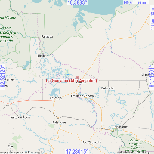
| Upper-left | 18.5683°, | -92.52126° |
| Center: | 17.90049°, | -91.81813° |
| Lower-right: | 17.23015°, | -91.11501° |
| Map W x H: | 148.8×148.8 km | = 92.5×92.5mi |
| max Lat: | 32.7° ⇑79.7% North |
| La Guayaba (Alto Amatitán): | 17.90049° |
| min Lat: | ⇓20.3% South 14.53588° |
| min Long | La Guayaba (Alt | max Long |
| -117.105° | -91.81813° | -86.73105° |
| W 95.8%⇐ | ⇒4.2% E |
Elevation
Elevation of La Guayaba (Alto Amatitán) is 6 m = 20 ft, and this is 1247.7 m = 4094 ft below average elevation for this country.
| Max E: |
3497 m = 11473 ft | 99.1% |
| Avg. | 1253.7 m = 4113 ft | |
| La Guayaba (Alto Amatitán) | 6 m = 20 ft | |
Min E: |
-1 m = -3 ft | 0.9% |
See also: Mexico elevation on elevation.city.
Geographical zone
La Guayaba (Alto Amatitán) is located in North Torrid zone (between Equator and Tropic of Cancer). Distance of this Northern Tropic circle is 615.6 km =382.5 mi to North.| Distance of | km | miles | from La Guayaba (Alto Amatitán) |
|---|---|---|---|
| North Pole | 8016.7 | 4981.3 | to North |
| Arctic Circle | 5410.8 | 3362.1 | to North |
| Tropic Cancer | 615.6 | 382.5 | to North |
| Equator | 1990.3 | 1236.7 | to South |


Nearby cities:
15 places around La Guayaba (Alto Amatitán): (largest is in red/bold)
• Boca de San Jerónimo
10.1 km =6.3 mi,  272°
272°
• Calatraba
13.7 km =8.5 mi,  166°
166°
• Catazajá
28.4 km =17.6 mi,  226°
226°
• Chablé
6 km =3.7 mi,  139°
139°
• El Paraíso
26.6 km =16.5 mi,  243°
243°
• El Pípila
24.3 km =15.1 mi,  73°
73°
• Emiliano Zapata
18.6 km =11.6 mi,  162°
162°
• Ignacio Zaragoza
22.3 km =13.9 mi, 235°
• José María Morelos y Pavón Centro
24.4 km =15.2 mi,  178°
178°
• La Libertad
25.8 km =16 mi, 156°
• Loma Bonita
30.1 km =18.7 mi,  245°
245°
• Los Pájaros
27.4 km =17 mi, 271°
• Playa Larga
4 km =2.5 mi,  17°
17°
• Torno Largo 2da. Sección
21.8 km =13.5 mi,  275°
275°
• Vicente Guerrero
24.3 km =15.1 mi,  127°
127°
Sources, notices
• [Note1] Compared only with cities in Mexico existing in our database
• [Src1] Map data: © OpenStreetMap contributors (CC-BY-SA)
• [Src2] Other city data from geonames.org with taken over terms of usage.
• [Src3] Geographical zone / Annual Mean Temperature by Robert A. Rohde @ Wikipedia
