Benito Juárez Centro geodata
Benito Juárez Centro (Chiapas) is a populated place; located in Mexico in America/Mexico_City (GMT-6) time zone. With population of 512 people, there are 16417 cities with bigger population in this country. Compared to other cities in Mexico, 82.2% of cities are located further ↑North; 96% of cities are located further ←West and 89.4% of cities have higher elevation than Benito Juárez Centro. Note1
Current local time in Benito Juárez Centro:
08:35 AM, WednesdayDifference from your time zone: hours


Benito Juárez Centro GPS coordinates[2]
17° 36' 9.432" North, 91° 41' 48.984" West
| Map corner | latitude | longitude |
|---|---|---|
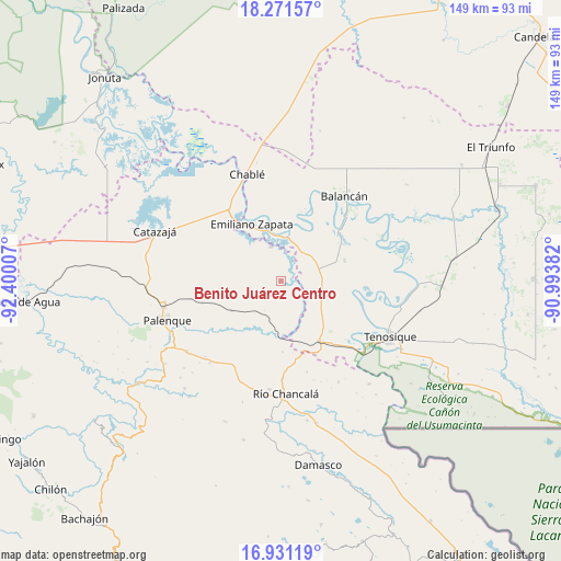
| Upper-left | 18.27157°, | -92.40007° |
| Center: | 17.60262°, | -91.69694° |
| Lower-right: | 16.93119°, | -90.99382° |
| Map W x H: | 149×149 km | = 92.6×92.6mi |
| max Lat: | 32.7° ⇑82.2% North |
| Benito Juárez Centro: | 17.60262° |
| min Lat: | ⇓17.8% South 14.53588° |
| min Long | Benito Juárez | max Long |
| -117.105° | -91.69694° | -86.73105° |
| W 96%⇐ | ⇒4% E |
Elevation
Elevation of Benito Juárez Centro is 26 m = 85 ft, and this is 1227.7 m = 4028 ft below average elevation for this country.
| Max E: |
3497 m = 11473 ft | 89.4% |
| Avg. | 1253.7 m = 4113 ft | |
| Benito Juárez Centro | 26 m = 85 ft | |
Min E: |
-1 m = -3 ft | 10.6% |
See also: Mexico elevation on elevation.city.
Geographical zone
Benito Juárez Centro is located in North Torrid zone (between Equator and Tropic of Cancer). Distance of this Northern Tropic circle is 648.7 km =403.1 mi to North.| Distance of | km | miles | from Benito Juárez Centro |
|---|---|---|---|
| North Pole | 8049.8 | 5001.9 | to North |
| Arctic Circle | 5443.9 | 3382.7 | to North |
| Tropic Cancer | 648.7 | 403.1 | to North |
| Equator | 1957.2 | 1216.1 | to South |


Nearby cities:
15 places around Benito Juárez Centro: (largest is in red/bold)
• Arena de Hidalgo
19.7 km =12.2 mi,  144°
144°
• Calatraba
22 km =13.7 mi,  334°
334°
• Chacama
10.7 km =6.6 mi,  53°
53°
• El Clavo
25.2 km =15.7 mi,  163°
163°
• El Desierto
18.8 km =11.7 mi,  178°
178°
• Emiliano Zapata
17 km =10.6 mi, 334°
• General Luis Felipe Domínguez Suárez
18 km =11.2 mi,  70°
70°
• José María Morelos y Pavón Centro
15 km =9.3 mi,  305°
305°
• La Cascada
28.1 km =17.5 mi,  203°
203°
• La Isla
26.2 km =16.3 mi,  121°
121°
• La Libertad
9.8 km =6.1 mi,  345°
345°
• Leona Vicario
19.2 km =11.9 mi,  58°
58°
• Miguel Hidalgo
15.2 km =9.4 mi,  239°
239°
• Usumacinta
22.3 km =13.9 mi,  104°
104°
• Vicente Guerrero
19.4 km =12.1 mi,  19°
19°
Sources, notices
• [Note1] Compared only with cities in Mexico existing in our database
• [Src1] Map data: © OpenStreetMap contributors (CC-BY-SA)
• [Src2] Other city data from geonames.org with taken over terms of usage.
• [Src3] Geographical zone / Annual Mean Temperature by Robert A. Rohde @ Wikipedia
