Vicente Guerrero geodata
Vicente Guerrero (Chiapas) is a populated place; located in Mexico in America/Mexico_City (GMT-6) time zone. With population of 2,009 people, there are 4328 cities with bigger population in this country. Compared to other cities in Mexico, 93% of cities are located further ↑North; 87.3% of cities are located further ←West and 62.1% of cities have higher elevation than Vicente Guerrero. Note1


Vicente Guerrero GPS coordinates[2]
16° 40' 47.964" North, 93° 15' 40.752" West
| Map corner | latitude | longitude |
|---|---|---|
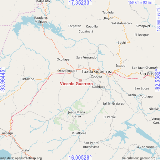
| Upper-left | 17.35233°, | -93.96445° |
| Center: | 16.67999°, | -93.26132° |
| Lower-right: | 16.00528°, | -92.5582° |
| Map W x H: | 149.8×149.8 km | = 93.1×93.1mi |
| max Lat: | 32.7° ⇑93% North |
| Vicente Guerrero: | 16.67999° |
| min Lat: | ⇓7% South 14.53588° |
| min Long | Vicente Guerrer | max Long |
| -117.105° | -93.26132° | -86.73105° |
| W 87.3%⇐ | ⇒12.7% E |
Elevation
Elevation of Vicente Guerrero is 876 m = 2874 ft, and this is 377.7 m = 1239 ft below average elevation for this country.
| Max E: |
3497 m = 11473 ft | 62.1% |
| Avg. | 1253.7 m = 4113 ft | |
| Vicente Guerrero | 876 m = 2874 ft | |
Min E: |
-1 m = -3 ft | 37.9% |
See also: Mexico elevation on elevation.city.
Geographical zone
Vicente Guerrero is located in North Torrid zone (between Equator and Tropic of Cancer). Distance of this Northern Tropic circle is 751.3 km =466.8 mi to North.| Distance of | km | miles | from Vicente Guerrero |
|---|---|---|---|
| North Pole | 8152.4 | 5065.7 | to North |
| Arctic Circle | 5546.5 | 3446.4 | to North |
| Tropic Cancer | 751.3 | 466.8 | to North |
| Equator | 1854.6 | 1152.4 | to South |


Nearby cities:
15 places around Vicente Guerrero: (largest is in red/bold)
• Berriozábal
13.2 km =8.2 mi,  355°
355°
• Ciudad Maya
8.8 km =5.5 mi,  318°
318°
• Copoya
15.4 km =9.6 mi,  76°
76°
• El Jobo
16.8 km =10.4 mi, 80°
• Emiliano Zapata
4.3 km =2.7 mi,  86°
86°
• Espinal de Morelos
18 km =11.2 mi,  280°
280°
• Guadalupe Victoria
9.8 km =6.1 mi,  232°
232°
• Hermenegildo Galeana
15.5 km =9.6 mi,  222°
222°
• Ignacio Zaragoza (El Morro)
13.1 km =8.1 mi, 226°
• La Independencia (Las Pilas)
1.3 km =0.8 mi,  102°
102°
• La Libertad
13.4 km =8.3 mi,  24°
24°
• Ocozocoautla de Espinosa
15.2 km =9.4 mi,  307°
307°
• Pacú
14.4 km =8.9 mi,  109°
109°
• Tuxtla
18.1 km =11.2 mi,  60°
60°
• Villahermosa (Reymundo Enríquez)
4.5 km =2.8 mi,  5°
5°
Sources, notices
• [Note1] Compared only with cities in Mexico existing in our database
• [Src1] Map data: © OpenStreetMap contributors (CC-BY-SA)
• [Src2] Other city data from geonames.org with taken over terms of usage.
• [Src3] Geographical zone / Annual Mean Temperature by Robert A. Rohde @ Wikipedia
