Bautista Grande geodata
Bautista Grande (Chiapas) is a populated place; located in Mexico in America/Mexico_City (GMT-6) time zone. With population of 684 people, there are 12694 cities with bigger population in this country. Compared to other cities in Mexico, 91.8% of cities are located further ↑North; 90.3% of cities are located further ←West and 91.8% of cities have lower elevation than Bautista Grande. Note1


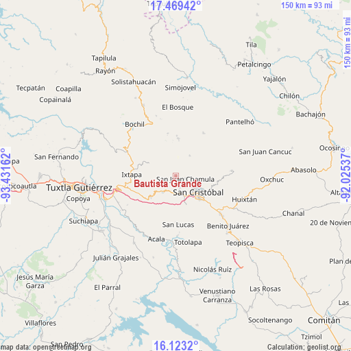
Bautista Grande GPS coordinates[2]
16° 47' 51" North, 92° 43' 42.564" West
| Map corner | latitude | longitude |
|---|---|---|
| Upper-left | 17.46942°, | -93.43162° |
| Center: | 16.7975°, | -92.72849° |
| Lower-right: | 16.1232°, | -92.02537° |
| Map W x H: | 149.7×149.7 km | = 93×93mi |
| max Lat: | 32.7° ⇑91.8% North |
| Bautista Grande: | 16.7975° |
| min Lat: | ⇓8.2% South 14.53588° |
| min Long | Bautista Grande | max Long |
| -117.105° | -92.72849° | -86.73105° |
| W 90.3%⇐ | ⇒9.7% E |
Elevation
Elevation of Bautista Grande is 2474 m = 8117 ft, and this is 1220.3 m = 4004 ft above average elevation for this country.
| Max E: |
3497 m = 11473 ft | 8.2% |
| Bautista Grande | 2474 m 8117 ft | |
| Avg. | 1253.7 m = 4113 ft | |
Min E: |
-1 m = -3 ft | 91.8% |
See also: Mexico elevation on elevation.city.
Geographical zone
Bautista Grande is located in North Torrid zone (between Equator and Tropic of Cancer). Distance of this Northern Tropic circle is 738.2 km =458.7 mi to North.| Distance of | km | miles | from Bautista Grande |
|---|---|---|---|
| North Pole | 8139.4 | 5057.6 | to North |
| Arctic Circle | 5533.5 | 3438.4 | to North |
| Tropic Cancer | 738.2 | 458.7 | to North |
| Equator | 1867.7 | 1160.5 | to South |


Nearby cities:
15 places around Bautista Grande: (largest is in red/bold)
• Arvenza Uno
2.2 km =1.4 mi,  156°
156°
• Bahosil
2 km =1.2 mi,  177°
177°
• Bautista Chico
1.8 km =1.1 mi,  82°
82°
• Bechijtic
4.3 km =2.7 mi,  124°
124°
• Catishtic
2.2 km =1.4 mi,  207°
207°
• Chamula
4.4 km =2.7 mi,  109°
109°
• Cruz Quemada
4.7 km =2.9 mi,  50°
50°
• Cuchulumtic
3.4 km =2.1 mi,  131°
131°
• Jomalho
4.8 km =3 mi,  14°
14°
• Noctic
4 km =2.5 mi,  271°
271°
• Santa Ana
1.4 km =0.9 mi,  320°
320°
• Seteltón
1.7 km =1.1 mi, 8°
• Tzajaltetic
3.5 km =2.2 mi,  59°
59°
• Ukumtic
0.8 km =0.5 mi,  196°
196°
• Zinacantán
4.2 km =2.6 mi,  171°
171°
Sources, notices
• [Note1] Compared only with cities in Mexico existing in our database
• [Src1] Map data: © OpenStreetMap contributors (CC-BY-SA)
• [Src2] Other city data from geonames.org with taken over terms of usage.
• [Src3] Geographical zone / Annual Mean Temperature by Robert A. Rohde @ Wikipedia
