Cuchulumtic geodata
Cuchulumtic (Chiapas) is a populated place; located in Mexico in America/Mexico_City (GMT-6) time zone. With population of 1,275 people, there are 6794 cities with bigger population in this country. Compared to other cities in Mexico, 92% of cities are located further ↑North; 90.5% of cities are located further ←West and 84.9% of cities have lower elevation than Cuchulumtic. Note1


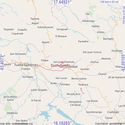
Cuchulumtic GPS coordinates[2]
16° 46' 37.992" North, 92° 42' 15.012" West
| Map corner | latitude | longitude |
|---|---|---|
| Upper-left | 17.44921°, | -93.4073° |
| Center: | 16.77722°, | -92.70417° |
| Lower-right: | 16.10285°, | -92.00105° |
| Map W x H: | 149.7×149.7 km | = 93×93mi |
| max Lat: | 32.7° ⇑92% North |
| Cuchulumtic: | 16.77722° |
| min Lat: | ⇓8% South 14.53588° |
| min Long | Cuchulumtic | max Long |
| -117.105° | -92.70417° | -86.73105° |
| W 90.5%⇐ | ⇒9.5% E |
Elevation
Elevation of Cuchulumtic is 2257 m = 7405 ft, and this is 1003.3 m = 3292 ft above average elevation for this country.
| Max E: |
3497 m = 11473 ft | 15.1% |
| Cuchulumtic | 2257 m 7405 ft | |
| Avg. | 1253.7 m = 4113 ft | |
Min E: |
-1 m = -3 ft | 84.9% |
See also: Mexico elevation on elevation.city.
Geographical zone
Cuchulumtic is located in North Torrid zone (between Equator and Tropic of Cancer). Distance of this Northern Tropic circle is 740.5 km =460.1 mi to North.| Distance of | km | miles | from Cuchulumtic |
|---|---|---|---|
| North Pole | 8141.6 | 5059 | to North |
| Arctic Circle | 5535.7 | 3439.7 | to North |
| Tropic Cancer | 740.5 | 460.1 | to North |
| Equator | 1865.5 | 1159.2 | to South |


Nearby cities:
15 places around Cuchulumtic: (largest is in red/bold)
• Arvenza Uno
1.7 km =1.1 mi,  279°
279°
• Bahosil
2.5 km =1.6 mi, 275°
• Bautista Chico
2.6 km =1.6 mi,  341°
341°
• Bautista Grande
3.4 km =2.1 mi,  311°
311°
• Bechijtic
1 km =0.6 mi,  102°
102°
• Catishtic
3.6 km =2.2 mi, 275°
• Chamula
1.7 km =1.1 mi,  63°
63°
• Ichintón
2.9 km =1.8 mi,  125°
125°
• La Selva Natividad
2.7 km =1.7 mi,  143°
143°
• La Ventana
1.6 km =1 mi, 143°
• Laguna Petej
4.1 km =2.5 mi,  70°
70°
• Nichén
3.5 km =2.2 mi,  38°
38°
• Tzajaltetic
4 km =2.5 mi,  5°
5°
• Ukumtic
3.2 km =2 mi,  298°
298°
• Zinacantán
2.7 km =1.7 mi,  225°
225°
Sources, notices
• [Note1] Compared only with cities in Mexico existing in our database
• [Src1] Map data: © OpenStreetMap contributors (CC-BY-SA)
• [Src2] Other city data from geonames.org with taken over terms of usage.
• [Src3] Geographical zone / Annual Mean Temperature by Robert A. Rohde @ Wikipedia
