Cruz Quemada geodata
Cruz Quemada (Chiapas) is a populated place; located in Mexico in America/Mexico_City (GMT-6) time zone. With population of 678 people, there are 12811 cities with bigger population in this country. Compared to other cities in Mexico, 91.4% of cities are located further ↑North; 90.5% of cities are located further ←West and 87.7% of cities have lower elevation than Cruz Quemada. Note1


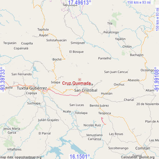
Cruz Quemada GPS coordinates[2]
16° 49' 27.516" North, 92° 41' 39.12" West
| Map corner | latitude | longitude |
|---|---|---|
| Upper-left | 17.49613°, | -93.39733° |
| Center: | 16.82431°, | -92.6942° |
| Lower-right: | 16.1501°, | -91.99108° |
| Map W x H: | 149.7×149.7 km | = 93×93mi |
| max Lat: | 32.7° ⇑91.4% North |
| Cruz Quemada: | 16.82431° |
| min Lat: | ⇓8.6% South 14.53588° |
| min Long | Cruz Quemada | max Long |
| -117.105° | -92.6942° | -86.73105° |
| W 90.5%⇐ | ⇒9.5% E |
Elevation
Elevation of Cruz Quemada is 2332 m = 7651 ft, and this is 1078.3 m = 3538 ft above average elevation for this country.
| Max E: |
3497 m = 11473 ft | 12.3% |
| Cruz Quemada | 2332 m 7651 ft | |
| Avg. | 1253.7 m = 4113 ft | |
Min E: |
-1 m = -3 ft | 87.7% |
See also: Mexico elevation on elevation.city.
Geographical zone
Cruz Quemada is located in North Torrid zone (between Equator and Tropic of Cancer). Distance of this Northern Tropic circle is 735.2 km =456.8 mi to North.| Distance of | km | miles | from Cruz Quemada |
|---|---|---|---|
| North Pole | 8136.4 | 5055.7 | to North |
| Arctic Circle | 5530.5 | 3436.5 | to North |
| Tropic Cancer | 735.2 | 456.8 | to North |
| Equator | 1870.7 | 1162.4 | to South |


Nearby cities:
15 places around Cruz Quemada: (largest is in red/bold)
• Bautista Chico
3.3 km =2.1 mi,  214°
214°
• Bautista Grande
4.7 km =2.9 mi,  230°
230°
• Chamula
4.5 km =2.8 mi,  173°
173°
• Chicviltenal
3.2 km =2 mi,  88°
88°
• Jomalho
3 km =1.9 mi,  304°
304°
• Laguna Petej
4.8 km =3 mi,  143°
143°
• Macvilhó
3.7 km =2.3 mi,  0°
0°
• Majomut
4.6 km =2.9 mi,  53°
53°
• Nichén
2.8 km =1.7 mi,  156°
156°
• Pilalchén
2.1 km =1.3 mi,  28°
28°
• Santa Ana
4.9 km =3 mi,  247°
247°
• Seteltón
3.6 km =2.2 mi, 249°
• Shucutón
4.7 km =2.9 mi,  82°
82°
• Tentic
4.5 km =2.8 mi,  16°
16°
• Tzajaltetic
1.4 km =0.9 mi, 209°
Sources, notices
• [Note1] Compared only with cities in Mexico existing in our database
• [Src1] Map data: © OpenStreetMap contributors (CC-BY-SA)
• [Src2] Other city data from geonames.org with taken over terms of usage.
• [Src3] Geographical zone / Annual Mean Temperature by Robert A. Rohde @ Wikipedia
