Niños Héroes geodata
Niños Héroes (Chiapas) is a populated place; located in Mexico in America/Mexico_City (GMT-6) time zone. With population of 805 people, there are 10845 cities with bigger population in this country. Compared to other cities in Mexico, 96.9% of cities are located further ↑North; 91% of cities are located further ←West and 66.7% of cities have higher elevation than Niños Héroes. Note1


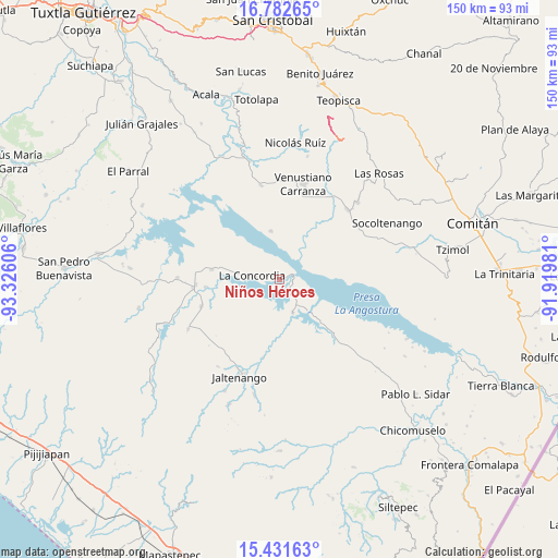
Niños Héroes GPS coordinates[2]
16° 6' 29.844" North, 92° 37' 22.548" West
| Map corner | latitude | longitude |
|---|---|---|
| Upper-left | 16.78265°, | -93.32606° |
| Center: | 16.10829°, | -92.62293° |
| Lower-right: | 15.43163°, | -91.91981° |
| Map W x H: | 150.2×150.2 km | = 93.3×93.3mi |
| max Lat: | 32.7° ⇑96.9% North |
| Niños Héroes: | 16.10829° |
| min Lat: | ⇓3.1% South 14.53588° |
| min Long | Niños Héroes | max Long |
| -117.105° | -92.62293° | -86.73105° |
| W 91%⇐ | ⇒9% E |
Elevation
Elevation of Niños Héroes is 602 m = 1975 ft, and this is 651.7 m = 2138 ft below average elevation for this country.
| Max E: |
3497 m = 11473 ft | 66.7% |
| Avg. | 1253.7 m = 4113 ft | |
| Niños Héroes | 602 m = 1975 ft | |
Min E: |
-1 m = -3 ft | 33.3% |
See also: Mexico elevation on elevation.city.
Geographical zone
Niños Héroes is located in North Torrid zone (between Equator and Tropic of Cancer). Distance of this Northern Tropic circle is 814.8 km =506.3 mi to North.| Distance of | km | miles | from Niños Héroes |
|---|---|---|---|
| North Pole | 8216 | 5105.2 | to North |
| Arctic Circle | 5610.1 | 3486 | to North |
| Tropic Cancer | 814.8 | 506.3 | to North |
| Equator | 1791.1 | 1112.9 | to South |


Nearby cities:
15 places around Niños Héroes: (largest is in red/bold)
• Benito Juárez
22.1 km =13.7 mi,  250°
250°
• El Santuario
19.8 km =12.3 mi,  87°
87°
• El Ámbar (El Ámbar de Echeverría)
22.5 km =14 mi,  266°
266°
• Emiliano Zapata
23.6 km =14.7 mi,  69°
69°
• Guadalupe Maravillas
24.9 km =15.5 mi,  134°
134°
• Ignacio Zaragoza
9.7 km =6 mi,  157°
157°
• Independencia
23.1 km =14.4 mi,  263°
263°
• La Concordia
7.3 km =4.5 mi,  278°
278°
• Nueva Libertad
19.9 km =12.4 mi, 264°
• Paraíso del Grijalva
13.2 km =8.2 mi,  350°
350°
• Plan de Agua Prieta
18.2 km =11.3 mi, 278°
• Presidente Echeverría (Laja Tendida)
25.8 km =16 mi, 349°
• Reforma
21.5 km =13.4 mi,  192°
192°
• Rizo de Oro
21.4 km =13.3 mi,  135°
135°
• San Francisco (El Calvito)
24.6 km =15.3 mi,  15°
15°
Sources, notices
• [Note1] Compared only with cities in Mexico existing in our database
• [Src1] Map data: © OpenStreetMap contributors (CC-BY-SA)
• [Src2] Other city data from geonames.org with taken over terms of usage.
• [Src3] Geographical zone / Annual Mean Temperature by Robert A. Rohde @ Wikipedia
