Presidente Echeverría (Laja Tendida) geodata
Presidente Echeverría (Laja Tendida) (Chiapas) is a populated place; located in Mexico in America/Mexico_City (GMT-6) time zone. With population of 3,084 people, there are 2921 cities with bigger population in this country. Compared to other cities in Mexico, 95.4% of cities are located further ↑North; 90.7% of cities are located further ←West and 67.7% of cities have higher elevation than Presidente Echeverría (Laja Tendida). Note1
Current local time in Presidente Echeverría (Laja Tendida):
03:40 AM, WednesdayDifference from your time zone: hours


Presidente Echeverría (Laja Tendida) GPS coordinates[2]
16° 20' 8.988" North, 92° 40' 6.996" West
| Map corner | latitude | longitude |
|---|---|---|
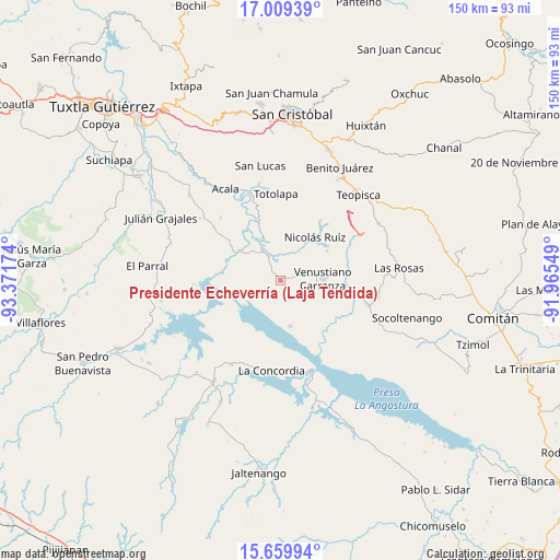
| Upper-left | 17.00939°, | -93.37174° |
| Center: | 16.33583°, | -92.66861° |
| Lower-right: | 15.65994°, | -91.96549° |
| Map W x H: | 150×150 km | = 93.2×93.2mi |
| max Lat: | 32.7° ⇑95.4% North |
| Presidente Echeverría (Laja Tendida): | 16.33583° |
| min Lat: | ⇓4.6% South 14.53588° |
| min Long | Presidente Eche | max Long |
| -117.105° | -92.66861° | -86.73105° |
| W 90.7%⇐ | ⇒9.3% E |
Elevation
Elevation of Presidente Echeverría (Laja Tendida) is 545 m = 1788 ft, and this is 708.7 m = 2325 ft below average elevation for this country.
| Max E: |
3497 m = 11473 ft | 67.7% |
| Avg. | 1253.7 m = 4113 ft | |
| Presidente Echeverría (Laja Tendida) | 545 m = 1788 ft | |
Min E: |
-1 m = -3 ft | 32.3% |
See also: Mexico elevation on elevation.city.
Geographical zone
Presidente Echeverría (Laja Tendida) is located in North Torrid zone (between Equator and Tropic of Cancer). Distance of this Northern Tropic circle is 789.5 km =490.6 mi to North.| Distance of | km | miles | from Presidente Echeverría (Laja Tendida) |
|---|---|---|---|
| North Pole | 8190.7 | 5089.5 | to North |
| Arctic Circle | 5584.8 | 3470.2 | to North |
| Tropic Cancer | 789.5 | 490.6 | to North |
| Equator | 1816.4 | 1128.7 | to South |


Nearby cities:
15 places around Presidente Echeverría (Laja Tendida): (largest is in red/bold)
• Belisario Domínguez
12.7 km =7.9 mi,  307°
307°
• Grandeza del Río Blanco
18.7 km =11.6 mi,  73°
73°
• Guadalupe Victoria
14.6 km =9.1 mi,  58°
58°
• La Gloria (La Tranca)
21.6 km =13.4 mi,  99°
99°
• Luis Echeverría Álvarez
16.3 km =10.1 mi,  304°
304°
• Mariano Matamoros
18.5 km =11.5 mi,  28°
28°
• Miguel Hidalgo
4.6 km =2.9 mi, 68°
• Nicolás Ruiz
14.4 km =8.9 mi,  38°
38°
• Nuevo León
19.7 km =12.2 mi, 31°
• Paraíso del Grijalva
12.5 km =7.8 mi,  167°
167°
• Ponciano Arriaga
17.6 km =10.9 mi,  15°
15°
• Ricardo Flores Magón
7.1 km =4.4 mi,  335°
335°
• San Francisco (El Calvito)
11.5 km =7.1 mi, 97°
• Venustiano Carranza
11.3 km =7 mi,  88°
88°
• Vicente Guerrero
12.4 km =7.7 mi, 337°
Sources, notices
• [Note1] Compared only with cities in Mexico existing in our database
• [Src1] Map data: © OpenStreetMap contributors (CC-BY-SA)
• [Src2] Other city data from geonames.org with taken over terms of usage.
• [Src3] Geographical zone / Annual Mean Temperature by Robert A. Rohde @ Wikipedia
