Ricardo Flores Magón geodata
Ricardo Flores Magón (Chiapas) is a populated place; located in Mexico in America/Mexico_City (GMT-6) time zone. With population of 3,483 people, there are 2624 cities with bigger population in this country. Compared to other cities in Mexico, 95% of cities are located further ↑North; 90.5% of cities are located further ←West and 68.8% of cities have higher elevation than Ricardo Flores Magón. Note1


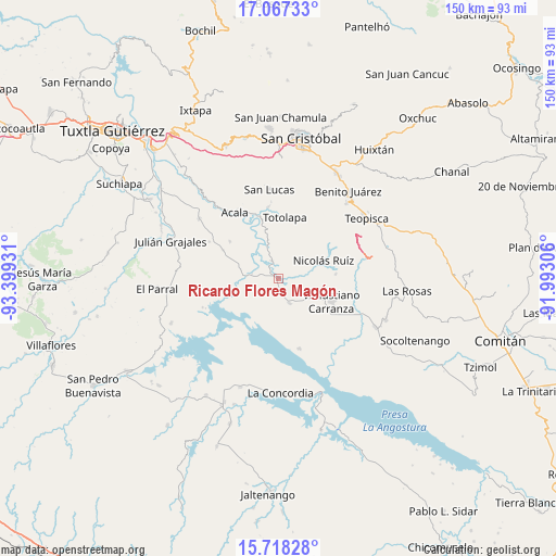
Ricardo Flores Magón GPS coordinates[2]
16° 23' 38.292" North, 92° 41' 46.248" West
| Map corner | latitude | longitude |
|---|---|---|
| Upper-left | 17.06733°, | -93.39931° |
| Center: | 16.39397°, | -92.69618° |
| Lower-right: | 15.71828°, | -91.99306° |
| Map W x H: | 150×150 km | = 93.2×93.2mi |
| max Lat: | 32.7° ⇑95% North |
| Ricardo Flores Magón: | 16.39397° |
| min Lat: | ⇓5% South 14.53588° |
| min Long | Ricardo Flores | max Long |
| -117.105° | -92.69618° | -86.73105° |
| W 90.5%⇐ | ⇒9.5% E |
Elevation
Elevation of Ricardo Flores Magón is 480 m = 1575 ft, and this is 773.7 m = 2538 ft below average elevation for this country.
| Max E: |
3497 m = 11473 ft | 68.8% |
| Avg. | 1253.7 m = 4113 ft | |
| Ricardo Flores Magón | 480 m = 1575 ft | |
Min E: |
-1 m = -3 ft | 31.2% |
See also: Mexico elevation on elevation.city.
Geographical zone
Ricardo Flores Magón is located in North Torrid zone (between Equator and Tropic of Cancer). Distance of this Northern Tropic circle is 783.1 km =486.6 mi to North.| Distance of | km | miles | from Ricardo Flores Magón |
|---|---|---|---|
| North Pole | 8184.2 | 5085.4 | to North |
| Arctic Circle | 5578.3 | 3466.2 | to North |
| Tropic Cancer | 783.1 | 486.6 | to North |
| Equator | 1822.8 | 1132.6 | to South |


Nearby cities:
15 places around Ricardo Flores Magón: (largest is in red/bold)
• Belisario Domínguez
7.3 km =4.5 mi,  280°
280°
• Guadalupe Victoria
15.4 km =9.6 mi,  85°
85°
• Luis Echeverría Álvarez
10.8 km =6.7 mi,  285°
285°
• Lázaro Cárdenas
19.1 km =11.9 mi,  338°
338°
• Mariano Matamoros
15.3 km =9.5 mi,  50°
50°
• Miguel Hidalgo
8.7 km =5.4 mi,  123°
123°
• Nicolás Ruiz
12.8 km =8 mi,  67°
67°
• Nuevo León
16.8 km =10.4 mi, 52°
• Ponciano Arriaga
12.9 km =8 mi,  35°
35°
• Presidente Echeverría (Laja Tendida)
7.1 km =4.4 mi,  155°
155°
• San Francisco (El Calvito)
16.4 km =10.2 mi, 119°
• Totolapa
16.7 km =10.4 mi,  5°
5°
• Unión Buena Vista
16.5 km =10.3 mi,  308°
308°
• Venustiano Carranza
15.5 km =9.6 mi,  113°
113°
• Vicente Guerrero
5.3 km =3.3 mi, 340°
Sources, notices
• [Note1] Compared only with cities in Mexico existing in our database
• [Src1] Map data: © OpenStreetMap contributors (CC-BY-SA)
• [Src2] Other city data from geonames.org with taken over terms of usage.
• [Src3] Geographical zone / Annual Mean Temperature by Robert A. Rohde @ Wikipedia
