Jericó geodata
Jericó (Chiapas) is a populated place; located in Mexico in America/Mexico_City (GMT-6) time zone. With population of 2,467 people, there are 3584 cities with bigger population in this country. Compared to other cities in Mexico, 95.8% of cities are located further ↑North; 88.8% of cities are located further ←West and 66% of cities have higher elevation than Jericó. Note1


Jericó GPS coordinates[2]
16° 17' 13.668" North, 92° 57' 58.68" West
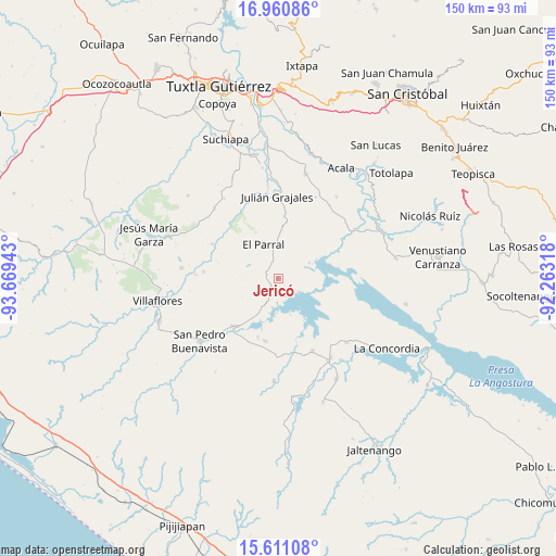
| Map corner | latitude | longitude |
|---|---|---|
| Upper-left | 16.96086°, | -93.66943° |
| Center: | 16.28713°, | -92.9663° |
| Lower-right: | 15.61108°, | -92.26318° |
| Map W x H: | 150.1×150.1 km | = 93.3×93.3mi |
| max Lat: | 32.7° ⇑95.8% North |
| Jericó: | 16.28713° |
| min Lat: | ⇓4.2% South 14.53588° |
| min Long | Jericó | max Long |
| -117.105° | -92.9663° | -86.73105° |
| W 88.8%⇐ | ⇒11.2% E |
Elevation
Elevation of Jericó is 634 m = 2080 ft, and this is 619.7 m = 2033 ft below average elevation for this country.
| Max E: |
3497 m = 11473 ft | 66% |
| Avg. | 1253.7 m = 4113 ft | |
| Jericó | 634 m = 2080 ft | |
Min E: |
-1 m = -3 ft | 34% |
See also: Mexico elevation on elevation.city.
Geographical zone
Jericó is located in North Torrid zone (between Equator and Tropic of Cancer). Distance of this Northern Tropic circle is 795 km =494 mi to North.| Distance of | km | miles | from Jericó |
|---|---|---|---|
| North Pole | 8196.1 | 5092.8 | to North |
| Arctic Circle | 5590.2 | 3473.6 | to North |
| Tropic Cancer | 795 | 494 | to North |
| Equator | 1811 | 1125.3 | to South |


Nearby cities:
15 places around Jericó: (largest is in red/bold)
• Diamante de Echeverría
21.6 km =13.4 mi,  154°
154°
• Dieciséis de Septiembre
22.3 km =13.9 mi,  272°
272°
• Doctor Manuel Velasco Suárez
9.4 km =5.8 mi,  63°
63°
• El Parral
10.2 km =6.3 mi,  335°
335°
• Embarcadero de Jericó (El Siglo)
10.2 km =6.3 mi,  161°
161°
• Ignacio Zaragoza
20.3 km =12.6 mi,  297°
297°
• Julián Grajales
22.2 km =13.8 mi,  359°
359°
• Loma Bonita
9.1 km =5.7 mi,  183°
183°
• Luis Echeverría Álvarez
23.6 km =14.7 mi,  51°
51°
• Manuel Ávila Camacho
16.6 km =10.3 mi,  199°
199°
• Nicolás Bravo
25 km =15.5 mi,  353°
353°
• Nuevo Vicente Guerrero (El Chichonal)
24.2 km =15 mi,  24°
24°
• Revolución Mexicana
17.4 km =10.8 mi,  222°
222°
• Santiago
17.3 km =10.7 mi, 197°
• Villa Hidalgo
20.2 km =12.6 mi,  275°
275°
Sources, notices
• [Note1] Compared only with cities in Mexico existing in our database
• [Src1] Map data: © OpenStreetMap contributors (CC-BY-SA)
• [Src2] Other city data from geonames.org with taken over terms of usage.
• [Src3] Geographical zone / Annual Mean Temperature by Robert A. Rohde @ Wikipedia
