Doctor Manuel Velasco Suárez geodata
Doctor Manuel Velasco Suárez (Chiapas) is a populated place; located in Mexico in America/Mexico_City (GMT-6) time zone. With population of 617 people, there are 13976 cities with bigger population in this country. Compared to other cities in Mexico, 95.5% of cities are located further ↑North; 89.3% of cities are located further ←West and 67.4% of cities have higher elevation than Doctor Manuel Velasco Suárez. Note1
Current local time in Doctor Manuel Velasco Suárez:
06:53 AM, WednesdayDifference from your time zone: hours


Doctor Manuel Velasco Suárez GPS coordinates[2]
16° 19' 30.288" North, 92° 53' 16.008" West
| Map corner | latitude | longitude |
|---|---|---|
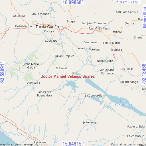
| Upper-left | 16.99868°, | -93.59091° |
| Center: | 16.32508°, | -92.88778° |
| Lower-right: | 15.64915°, | -92.18466° |
| Map W x H: | 150.1×150.1 km | = 93.3×93.3mi |
| max Lat: | 32.7° ⇑95.5% North |
| Doctor Manuel Velasco Suárez: | 16.32508° |
| min Lat: | ⇓4.5% South 14.53588° |
| min Long | Doctor Manuel V | max Long |
| -117.105° | -92.88778° | -86.73105° |
| W 89.3%⇐ | ⇒10.7% E |
Elevation
Elevation of Doctor Manuel Velasco Suárez is 561 m = 1841 ft, and this is 692.7 m = 2273 ft below average elevation for this country.
| Max E: |
3497 m = 11473 ft | 67.4% |
| Avg. | 1253.7 m = 4113 ft | |
| Doctor Manuel Velasco Suárez | 561 m = 1841 ft | |
Min E: |
-1 m = -3 ft | 32.6% |
See also: Mexico elevation on elevation.city.
Geographical zone
Doctor Manuel Velasco Suárez is located in North Torrid zone (between Equator and Tropic of Cancer). Distance of this Northern Tropic circle is 790.7 km =491.3 mi to North.| Distance of | km | miles | from Doctor Manuel Velasco Suárez |
|---|---|---|---|
| North Pole | 8191.9 | 5090.2 | to North |
| Arctic Circle | 5586 | 3471 | to North |
| Tropic Cancer | 790.7 | 491.3 | to North |
| Equator | 1815.2 | 1127.9 | to South |


Nearby cities:
15 places around Doctor Manuel Velasco Suárez: (largest is in red/bold)
• Belisario Domínguez
16 km =9.9 mi,  56°
56°
• Diamante de Echeverría
23.7 km =14.7 mi,  177°
177°
• El Parral
13.5 km =8.4 mi,  291°
291°
• Embarcadero de Jericó (El Siglo)
14.8 km =9.2 mi,  200°
200°
• Jericó
9.4 km =5.8 mi,  243°
243°
• Julián Grajales
20 km =12.4 mi,  334°
334°
• Loma Bonita
16 km =9.9 mi,  213°
213°
• Luis Echeverría Álvarez
14.5 km =9 mi,  43°
43°
• Nicolás Bravo
23.4 km =14.5 mi, 331°
• Nuevo Vicente Guerrero (El Chichonal)
17.9 km =11.1 mi,  5°
5°
• Plan de Agua Prieta
23.9 km =14.9 mi,  154°
154°
• Presidente Echeverría (Laja Tendida)
23.4 km =14.5 mi,  87°
87°
• Ricardo Flores Magón
21.8 km =13.5 mi,  69°
69°
• Unión Buena Vista
19.4 km =12.1 mi,  22°
22°
• Vicente Guerrero
22.6 km =14 mi, 55°
Sources, notices
• [Note1] Compared only with cities in Mexico existing in our database
• [Src1] Map data: © OpenStreetMap contributors (CC-BY-SA)
• [Src2] Other city data from geonames.org with taken over terms of usage.
• [Src3] Geographical zone / Annual Mean Temperature by Robert A. Rohde @ Wikipedia
