El Parral geodata
El Parral (Chiapas) is a populated place; located in Mexico in America/Mexico_City (GMT-6) time zone. With population of 10,865 people, there are 875 cities with bigger population in this country. Compared to other cities in Mexico, 95.2% of cities are located further ↑North; 88.5% of cities are located further ←West and 65.6% of cities have higher elevation than El Parral. Note1


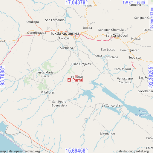
El Parral GPS coordinates[2]
16° 22' 13.26" North, 93° 0' 20.412" West
| Map corner | latitude | longitude |
|---|---|---|
| Upper-left | 17.04379°, | -93.7088° |
| Center: | 16.37035°, | -93.00567° |
| Lower-right: | 15.69458°, | -92.30255° |
| Map W x H: | 150×150 km | = 93.2×93.2mi |
| max Lat: | 32.7° ⇑95.2% North |
| El Parral: | 16.37035° |
| min Lat: | ⇓4.8% South 14.53588° |
| min Long | El Parral | max Long |
| -117.105° | -93.00567° | -86.73105° |
| W 88.5%⇐ | ⇒11.5% E |
Elevation
Elevation of El Parral is 656 m = 2152 ft, and this is 597.7 m = 1961 ft below average elevation for this country.
| Max E: |
3497 m = 11473 ft | 65.6% |
| Avg. | 1253.7 m = 4113 ft | |
| El Parral | 656 m = 2152 ft | |
Min E: |
-1 m = -3 ft | 34.4% |
See also: Mexico elevation on elevation.city.
Geographical zone
El Parral is located in North Torrid zone (between Equator and Tropic of Cancer). Distance of this Northern Tropic circle is 785.7 km =488.2 mi to North.| Distance of | km | miles | from El Parral |
|---|---|---|---|
| North Pole | 8186.8 | 5087 | to North |
| Arctic Circle | 5581 | 3467.9 | to North |
| Tropic Cancer | 785.7 | 488.2 | to North |
| Equator | 1820.2 | 1131 | to South |


Nearby cities:
15 places around El Parral: (largest is in red/bold)
• Cuauhtémoc
22.7 km =14.1 mi,  254°
254°
• Dieciséis de Septiembre
19.8 km =12.3 mi, 245°
• Doctor Manuel Velasco Suárez
13.5 km =8.4 mi,  111°
111°
• Embarcadero de Jericó (El Siglo)
20.3 km =12.6 mi,  158°
158°
• Francisco Sarabia
20.6 km =12.8 mi,  0°
0°
• Ignacio Allende
17.3 km =10.7 mi, 4°
• Ignacio Zaragoza
13.7 km =8.5 mi,  270°
270°
• Jericó
10.2 km =6.3 mi, 155°
• Julián Grajales
13.5 km =8.4 mi,  16°
16°
• La Palma
20.2 km =12.6 mi,  324°
324°
• Loma Bonita
18.7 km =11.6 mi,  168°
168°
• Nicolás Bravo
15.7 km =9.8 mi,  5°
5°
• Nuevo Vicente Guerrero (El Chichonal)
19.2 km =11.9 mi,  48°
48°
• Palenque de los Pinos
16.4 km =10.2 mi, 320°
• Villa Hidalgo
17.5 km =10.9 mi, 245°
Sources, notices
• [Note1] Compared only with cities in Mexico existing in our database
• [Src1] Map data: © OpenStreetMap contributors (CC-BY-SA)
• [Src2] Other city data from geonames.org with taken over terms of usage.
• [Src3] Geographical zone / Annual Mean Temperature by Robert A. Rohde @ Wikipedia
